


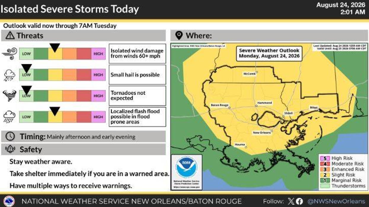

Another day brings another round of summer storms to the New Orleans metro.
The National Weather Service has placed all of Southeast Louisiana under a Level 2, or slight, storm risk for Monday. Those storms will hit the region in the early- to mid-afternoon hours, bringing damaging wind gusts of up to 60 miles per hour with them. The storms will also produce heavy downpours and flash flooding, lightning, and, in some cases, hail. Those storms will push out of the region by the evening.
The probability of storms remains in the forecast for the rest of the week, with precipitation chances at or near 40 percent through the upcoming weekend. High temperatures will peak in the low- to mid-90s. Overnight lows will settle in the upper-70s.
MONDAY:
Partly cloudy. 80% chance few showers and storms. Hot, humid. Low: S 79, N 76. High: 96.
TUESDAY:
Partly cloudy. 30-40% chance few showers and storms. Hot, humid. Low: S 78, N 76. High: 93.
WEDNESDAY:
Partly cloudy. 30-40% chance few showers and storms. Hot, humid. Low: S 78, N 76. High: 92.
THURSDAY:
Partly cloudy. 40% chance few showers and storms. Hot, humid. Low: S 78, N 76. High: 93.
FRIDAY:
Partly cloudy. 40% chance few showers and storms. Hot, humid. Low: S 77, N 75. High: 92.
SATURDAY:
Partly cloudy. 40% chance few showers and storms. Hot, humid. Low: S 77, N 75. High: 92.
Damaging winds, hail possible
Damaging winds, hail possible