


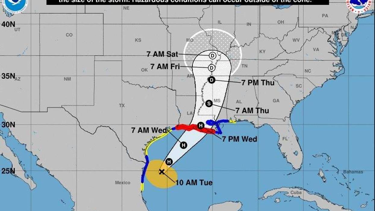
Tropical Storm Francine is now expected to make landfall closer to New Orleans and the bayou parishes, with St. Mary Parish now in the bullseye of Francine's path.
The National Hurricane Center's new forecast track for the storm shows that Francine's eye will cross the shore on the eastern edge of Vermilion Bay in St. Mary Parish due south of Franklin. Once on land, the eye is expected to pass bet between Franklin and Morgan City before moving just east of downtown Baton Rouge.
Francine remains a tropical storm for now. Maximum sustained winds remain at 65 miles per hour, but the storm's barometric pressure is falling.
Forecasters expect Francine to reach hurricane strength by the 4 p.m. advisory.
Although Francine is showing signs of strengthening and becoming better organized, the National Weather Service is backing away from forecasts that say Francine will be stronger than a Category 1 storm. That's because dry air is expected to enter the gulf and prevent Francine from becoming any stronger than a moderate Cat. 1 hurricane. Still, forecasters warn that conditions remain favorable for rapid intensification.
"Francine has about 24-30 (hours) to strengthen over warm water before it encounters strong shear near the Louisiana coast," NHC forecasters said in their 10 a.m. discussion. "While there is a possibility that dry air entrainment could reduce the intensification rate, the intensity continues to call for steady to rapid strengthening during this time based on the otherwise favorable conditions. While it is not explicitly shown in the latest forecast, the cyclone could reach a peak intensity near 85 kt between the 24 h point and landfall. Intensification is expected to stop before landfall, and rapid weakening is expected after landfall."
Hurricane warnings are in effect for Morgan City to Grand Isle. Tropical storm warnings are in effect for the Louisiana coast from Grand Isle to the mouth of the Mississippi/Alabama state line, including metropolitan New Orleans, Lake Pontchartrain, and Lake Maurepas.


