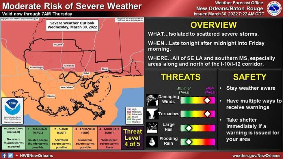
Tropical storm force winds are expected as a line of severe weather moves into the New Orleans region later this evening.
Forecasters say the squall line is moving quickly to the east. A Tornado Watch has been issued until 9 p.m. in Jefferson Parish and Orleans Parish.
“Severe thunderstorms are posing an increasing risk to produce tornadoes and/or strong, damaging wind gusts through 2-4 PM CDT. This may include increasing potential for a strong tornado or two by late afternoon,” says the National Weather Service.
The storm is forecasted to produce wind gusts of over 50 mph in some areas, which increases the threat of tornadoes.
 NWS
NWS
WEDNESDAY: Early sun, windy. Warm temps. Afternoon to evening severe storms. High: 85. Winds: S 15-25+ with gusts up to 55 mph.
THURSDAY: Some early clouds, then mostly sunny. Warm, but a bit less humid. Low: S 59, N 55.
High: 79.
FRIDAY: Cool morning. Sunny skies and nice! Low: S 56, N 49. High: 77.
SATURDAY: Increasing clouds. 40% scattered showers, few storms. Low: S 59, N 55. High: 79.
SUNDAY: Sunny skies. Very pleasant. Low: S 63, N 57. High: 79.
MONDAY: Mostly sunny. Warmer. Low: S 62, N 55. High: 82.
TUESDAY: Mostly cloudy. 30% scattered showers and some storms. Breezy. Warm and humid. Low: S 66, N 63. High: 84.