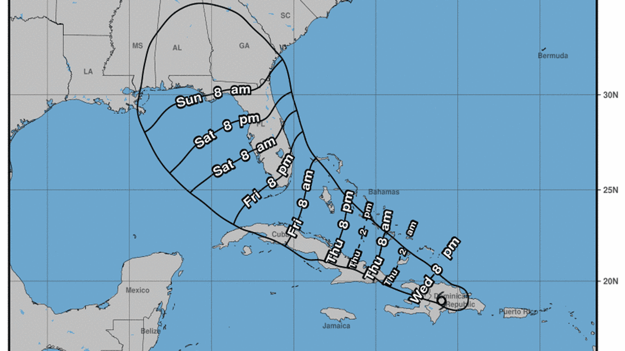
Tropical Storm Fred is now 75 miles WestSouthWest of Santo Domingo, Dominican Republic.
It is seeing maximum sustained winds of 40-miles-per-hour.
Fred is moving WestNorthWest at 15-miles-per-hour.
Fred is moving toward the west-northwest near 15 mph (24 km/h), and a general west-northwestward motion with a decrease in forward speed is expected to continue for the next two days or so.
On the forecast track, the center of Fred is expected to be over Hispaniola for the next several hours, move near the Turks and Caicos Islands and the southeastern Bahamas on Thursday, and move near or north of the northern coast of central Cuba Thursday night and Friday.
Maximum sustained winds are near 40 mph (65 km/h) with higher gusts.
Fred is expected to weaken to a depression tonight as it crosses Hispaniola.
Slow re-intensification is expected beginning Thursday night.
Tropical-storm-force winds extend outward up to 60 miles (95 km) mainly to the northeast of the center.
Across the Dominican Republic...3 to 5 inches, with isolated maximum totals of 8 inches.
Heavy rainfall through Thursday morning could lead to flash, urban, and small stream flooding, along with possible rapid river rises and the potential for mudslides.
Over Haiti, the Turks and Caicos, the eastern Bahamas, and Cuba...1 to 3 inches with isolated maximum totals of 5 inches.
Across the western Bahamas...3 to 5 inches, with isolated maximum totals of 8 inches.