


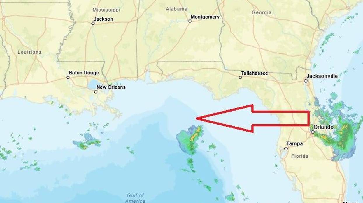
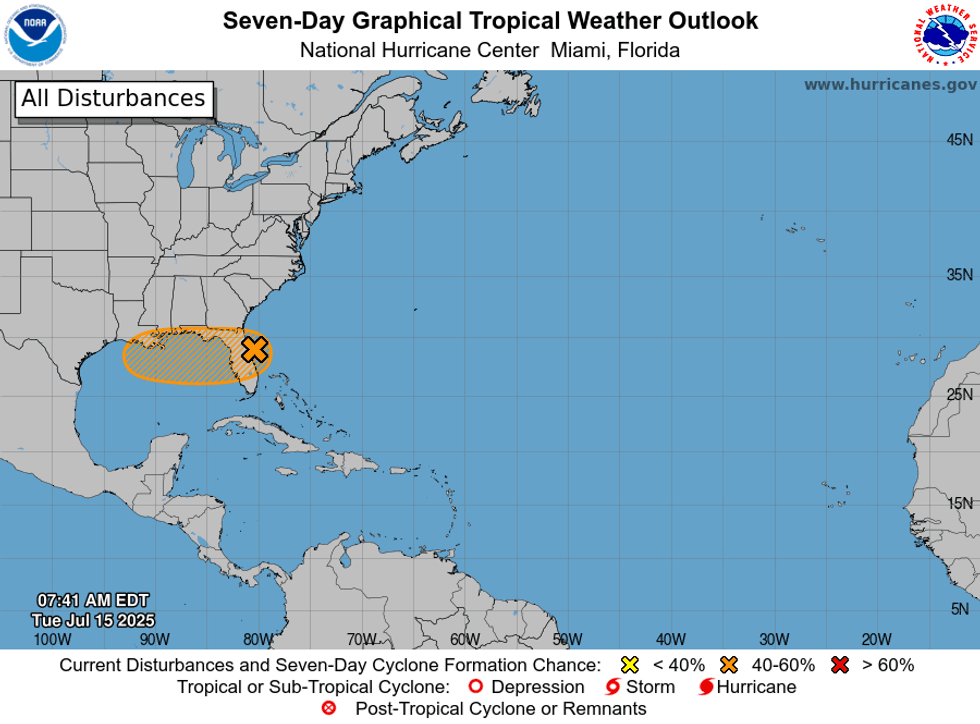
The National Hurricane Center says we could see tropical development in the Gulf over the next couple of days.
"Recent satellite-derived wind data indicate that the area of low pressure located just offshore of the east coast of Florida is gradually becoming better defined," Hurricane Specialist Andrew Hagen advised. "However, the shower and thunderstorm activity remains disorganized."
This system is forecast to reach the northeastern Gulf by the middle part of this week.
"Environmental conditions appear generally favorable for additional development, and a tropical depression could form."
Hagen says that regardless of development, heavy rainfall could produce localized flash flooding.
He currently gives it a 40% chance of development.
 NHC
NHC
WWL TV Meteorologist Payton Malone says how strong the system gets will depend how far north it enters the Gulf and how much time it spends over the water.
"Models show the disturbance traveling west and organizing throughout Wednesday and Thursday. Time over water will be very important. A disturbance that spends more time over the warm waters will have a better chance of becoming a named storm," he explained.
Malone says if the disturbance stays close to land it will only be a "sloppy rain maker."
However, if it has more time over water, the system will be able to get more organized and stronger.
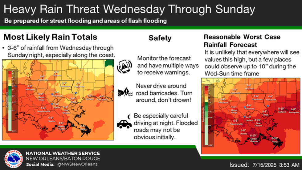
"Right now, heavy rain is the main threat between Wednesday and Friday, but if something were to better organize, winds and coastal flooding could become a concern. Stay tuned."
 NWS
NWS


