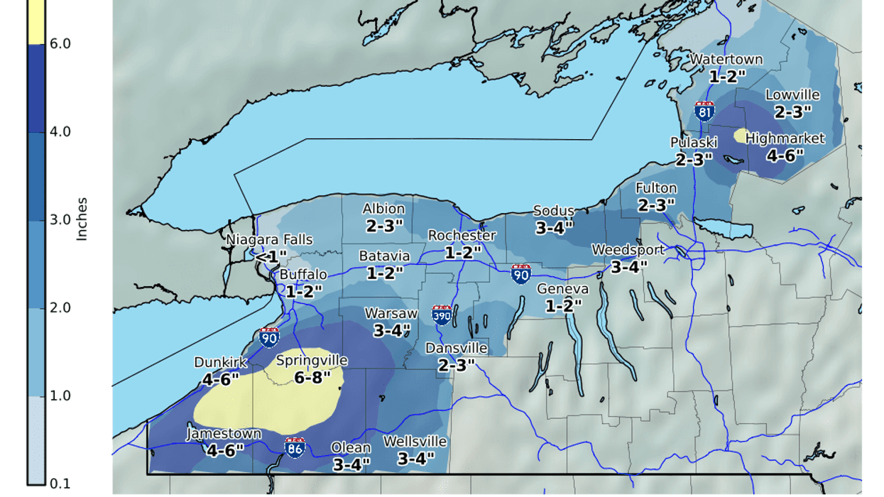
Buffalo, N.Y. (WBEN) - It will actually look and feel like January with colder temperatures and some snow across the region Wednesday. Most accumulating snow will be confined to the southern tier region where a Winter Weather Advisory is posted through this evening.
NARROW BANDS OF LAKE EFFECT SNOW AND BLOWING SNOW THIS EVENING... Numerous snow showers and narrow bands of lake effect snow will continue across much of Western New York, the Genesee Valley, and points southeast of Lake Ontario through early evening. A few of the bands of snow will briefly reduce visibility to a half mile or less. The bands of snow will not last long in any one location, with additional accumulations limited to around an inch in the persistent bands through 7 PM. Gusty winds will also produce some blowing and drifting snow in open areas.
WINTER WEATHER ADVISORY REMAINS IN EFFECT UNTIL 6 PM EST THISEVENING* WHAT...Lake effect snow. Additional snow accumulations of 2 to4 inches in the most persistent lake snows. Winds gusting ashigh as 35 mph.* WHERE...Allegany county.* WHEN...Until 6 PM EST this evening.* IMPACTS...Plan on slippery road conditions. Areas of blowingsnow could significantly reduce visibility.PRECAUTIONARY/PREPAREDNESS ACTIONS...Lake effect snow will fall in relatively narrow bands. Iftraveling, be prepared for rapidly changing road conditions andvisibilities.