The National Hurricane Center says that Tropical Storm Zeta should get stronger, now that it has emerged into the Gulf of Mexico. Top winds decreased to 65 miles per hour over Mexico.
"Zeta is forecast to re-strengthen while it moves over the southern Gulf of Mexico, and become a hurricane again later today. Zeta is forecast to be at or near hurricane strength when it reaches the northern Gulf Coast late Wednesday."

Landfall is forecast for Southeast Louisiana Wednesday evening as a hurricane.
"On the forecast track, the center of Zeta will move over the southern Gulf of Mexico later today and over the central Gulf of Mexico tonight. Zeta is forecast to approach the northern Gulf Coast on Wednesday, make landfall within the hurricane warning area late Wednesday or Wednesday night, and move inland across the southeastern United States early Thursday."
A Hurricane Warning is in effect from Morgan City, Louisiana to the Mississippi/Alabama border... including Lake Pontchartrain, Lake Maurepas, and Metropolitan New Orleans.
How will Zeta impact the Gulf Coast?
WIND:
The forecast calls for Zeta to bring some hurricane force winds to the Southeast Louisiana coast and possibly tropical storm force winds to the New Orleans area. That could cause large numbers of power outages.

RAIN:
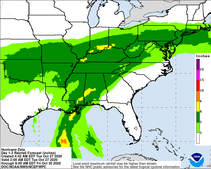
Zeta is forecast to dump two to four inches of rain from Southeast Louisiana to the Florida Panhandle. Some areas may see isolated amounts of up to six inches. That could cause some localized street flooding.
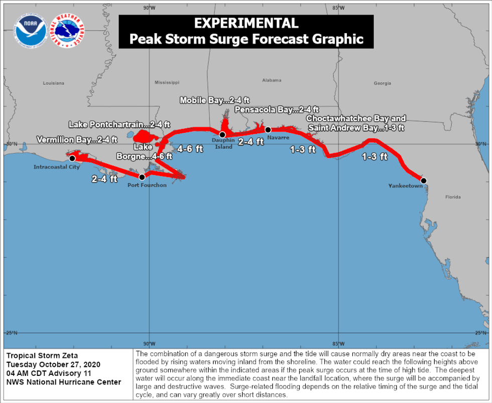
SURGE:
Coastal areas could see two to six feet of storm surge outside of levee protection. That could inundate some areas.