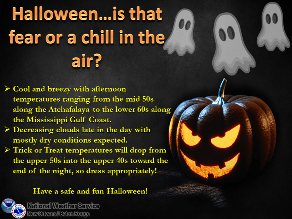
One of the coldest Halloweens ever in Southeast Louisiana is expected with a strong cold front moving in this afternoon.
"Halloween will feel wintry to many of us," WWL TV Meteorologist Payton Malone forecasts.
He says the temperatures plummet after noon today.
"Expect 40s north of the lake with 50s on the southshore."
It stays colder for Halloween.
"Expect a mostly cloudy and chilly day mainly in the 50s, falling into the 40s away from the city."
He says there will be a wind chill on top of that.
"A north wind will make it feel even colder, so consider adding a layer or two to your Halloween costume."
 NWS
NWS
Malone says it gets even colder the next couple of days.
"Wednesday and Thursday mornings will be the coldest with 40s south of the lake. Patchy frost may even form north of the lake where lows will be in the middle 30s."
We warm back onto the 70s for the weekend.
Detailed Forecast...
MONDAY:
Morning fog. Mostly cloudy. 10% chance of isolated showers.
Warm early, then cooler late. Becoming breezy. High: 76.
HALLOWEEN:
Mostly cloudy, windy. Staying chilly. 20% chance of isolated showers, mainly early. Low: S 53, N 49. High: 60. Evening temperatures in the 40s and 50s.
ALL SAINTS DAY:
Patchy frost possible for the Northshore. Becoming mostly sunny. Low: S 46, N 37. High: 60.
THURSDAY:
Morning frost Northshore. Chilly morning. Mostly sunny.
Cool. Low: S 47, N 35. High: 67.
FRIDAY:
Chilly morning. Pleasant afternoon. Mostly sunny. Low: S 52, N 41. High: 71.
SATURDAY:
Cool morning, Pleasant afternoon. Mostly sunny. Low: S 57, N 49. High: 75.
SUNDAY:
Cool morning, Pleasant afternoon. Mostly sunny. Low: S 59, N 51. High: 79.