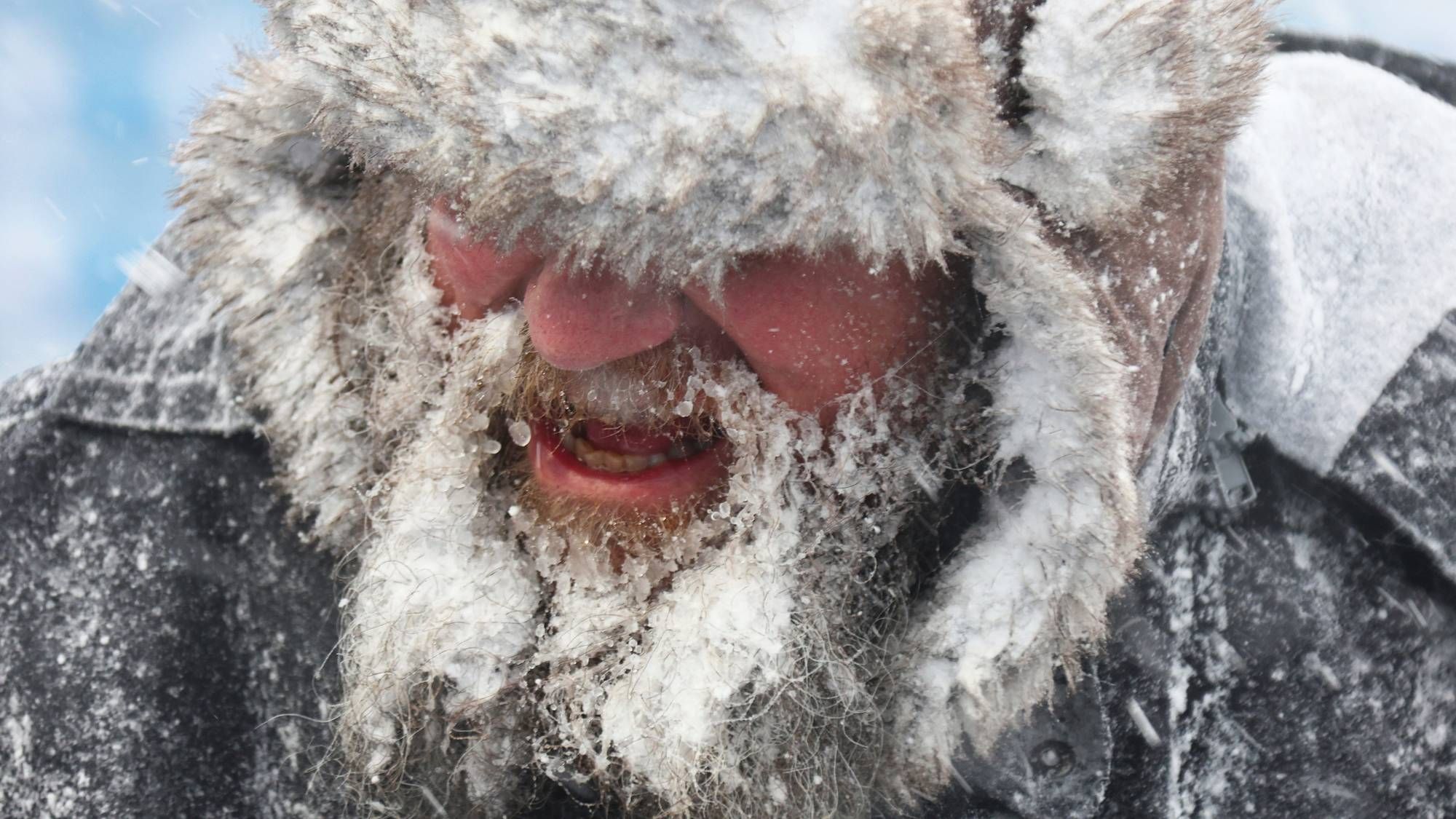
It's coming -- some of the coldest temperatures we have had in more than a year.
Parts of the Northshore could see freezing rain tonight into tomorrow.
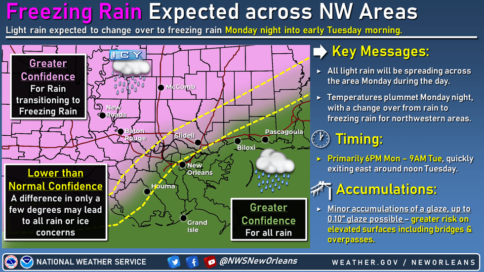 NWS
NWS
Tuesday morning will see lows in the 20s with wind chills in the teens on both sides of the lake.
Then it gets colder.
National Weather Service meteorologist Phil Grigsby in New Orleans says this freeze will cover a lot of southeastern Louisiana starting late Tuesday night.
"We're expecting temperatures to get down to the mid to upper teens across the Northshore all the way over to Baton Rouge and even west of the lake, like down through the River Parishes and potentially as far south as Houma," said Grigsby.
New Orleans gets a little protection from the lake, but not much.
"South of the lake, there's going to be a little bit of wind that will keep it warmer, but not much warmer," he explained. "It's going to be in the low- to mid-20s."
And the freeze will Last hours.
"Conditions could last all the way through mid-morning Wednesday before we finally warm back above freezing," said Grigsby.
That means unwrapped pipes could burst on both sides of the lake.
FORECAST DETAILS FOR NEW ORLEANS...
Tonight
Showers likely, mainly before 7pm. Cloudy, with a low around 29. Blustery, with a north wind 10 to 20 mph. Chance of precipitation is 60%. New precipitation amounts of less than a tenth of an inch possible.
Tuesday
Mostly cloudy through mid morning, then gradual clearing, with a high near 38. Wind chill values as low as 17. Breezy, with a north wind 15 to 20 mph.
Tuesday Night
Mostly clear, with a low around 24. Wind chill values as low as 17. North wind 10 to 15 mph.
Wednesday
Sunny, with a high near 44. North wind 5 to 10 mph becoming east in the afternoon.
Wednesday Night
Partly cloudy, with a low around 38.
Southeast wind around 5 mph.
Thursday
A 20 percent chance of showers after noon.
Mostly cloudy, with a high near 63. Southeast wind 5 to 10 mph.
Thursday Night
A 30 percent chance of showers, mainly before midnight. Mostly cloudy, with a low around 46. South wind 10 to 15 mph becoming north after midnight.
Friday
Mostly sunny, with a high near 53. Breezy, with a north wind 15 to 20 mph.
Friday Night
Clear, with a low around 30. Blustery, with a north wind 15 to 20 mph.
Saturday
Sunny, with a high near 46. North wind around 15 mph.
Saturday Night
Partly cloudy, with a low around 35.
Northeast wind around 15 mph.
Sunday
Mostly sunny, with a high near 51. East wind around 15 mph.
FORECAST DETAILS FOR NORTHSHORE...
Tonight
A chance of rain showers, freezing rain, and sleet before 3am, then a slight chance of rain showers and sleet between 3am and 4am. Cloudy, with a low around 23. Wind chill values as low as 11. North wind 10 to 15 mph. Chance of precipitation is 50%. Little or no ice accumulation expected. Little or no sleet accumulation expected.
Tuesday
Partly sunny through mid morning, then becoming sunny, with a high near 38. Wind chill values as low as 9. North wind around 15 mph.
Tuesday Night
Mostly clear, with a low around 16. North wind 5 to 15 mph.
Wednesday
Sunny, with a high near 46. North wind around 5 mph becoming southeast in the afternoon.
Wednesday Night
Partly cloudy, with a low around 31. East wind around 5 mph.
Thursday
A 30 percent chance of showers after noon.
Mostly cloudy, with a high near 62. East wind 5 to 10 mph becoming south in the afternoon.
Thursday Night
A 40 percent chance of showers, mainly before midnight. Mostly cloudy, with a low around 41. South wind 10 to 15 mph becoming north after midnight.
Friday
Sunny, with a high near 53. Breezy, with a north wind 15 to 20 mph.
Friday Night
Clear, with a low around 25. North wind around 15 mph.
Saturday
Sunny, with a high near 48. North wind 10 to 15 mph.
Saturday Night
Mostly clear, with a low around 28.
Northeast wind around 10 mph.
Sunday
Mostly sunny, with a high near 50. East wind around 10 mph.