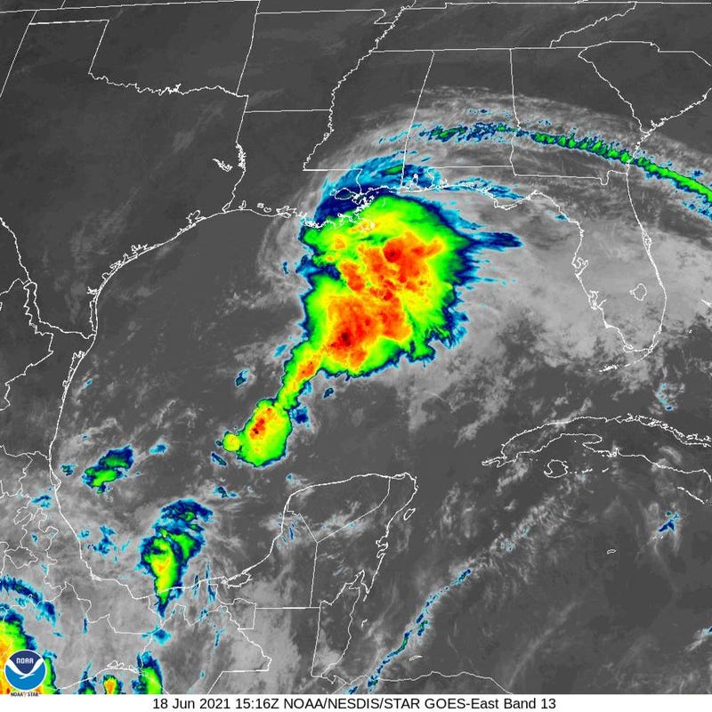

The Tropical system in the Gulf of Mexico is a bit further east than the National Hurricane Center thought.
"The Air Force Hurricane Hunters have been investigating the system and they found a surface center a little to the east of where we previously expected it to be," Senior Hurricane Specialist Eric Blake said. "The models are in good agreement, and the NHC track forecast is a little to the east of the previous one based on the initial position and motion."
With all of the rain associated with the system falling east of the center, that means less rain for Louisiana and more for Mississippi, Alabama and Florida.
"The trends overall have been for less rainfall across the area... with the worst impacts into Mississippi," WWL TV Meteorologist Payton Malone said. "We don't want to say we are in clear yet, though, with this thing so unpredictable and unorganized."
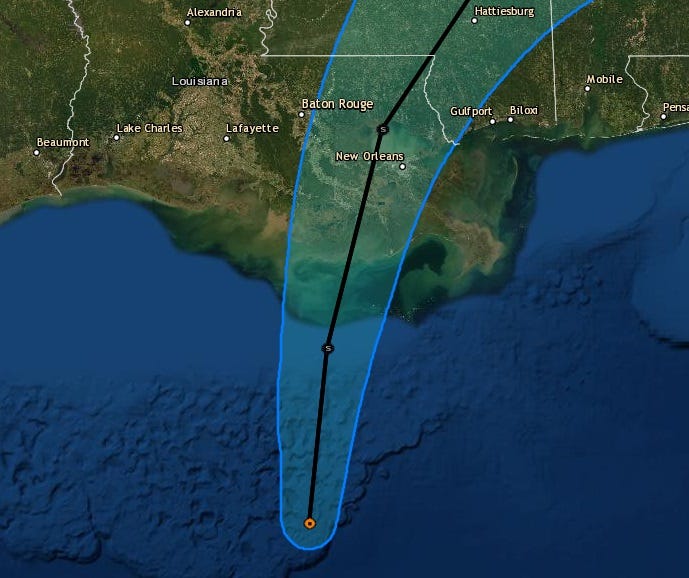
The Hurricane Center has canceled the Tropical Storm Warning west of Morgan City... it now stretches from Morgan City, through New Orleans and east to Walton County Florida.
Forecasters still expect it will become Tropical Storm Claudette.
"Although the system will likely become a tropical storm later today or tonight, significant strengthening is not expected due to its broad and asymmetric structure, ongoing west-southwesterly shear, and limited time over the Gulf of Mexico waters," Blake explained.
He also notes that the track for the landfall is a little misleading, with the primary impacts away from the center.
"Given the current and anticipated structure of this system, users should not focus on the exact track of the center, as rainfall and wind hazards are likely to extend well east of the center and arrive well in advance of landfall."
Key Messages from the Hurricane Center:
1. The system is expected to produce heavy rainfall, considerable flash, urban and small stream flooding beginning today and continuing through the weekend along the Central Gulf coast. Flood impacts will spread northeastward into the Southern Appalachians.
2. Tropical storm conditions are expected to begin later today in areas near and well to the east of the center along portions of the central Gulf Coast from Intracoastal City, Louisiana, to the Okaloosa/Walton County line, Florida, including New Orleans.