


Morning lows today dipped to the coldest we have seen in some eight months.
"The chilly weather is fully here! Morning temperatures were in the 30s and 40s across the Northshore. Southshore was mostly in the 50s," WWL TV Meteorologist Payton Malone said.
Wind chills had it feeling even colder.
Don't look for any temperatures in the 70s the next few days.
"Afternoon highs will remain below average and only in the low to then mid 60s into Saturday."
Malone says the coldest morning will be Saturday, with some frost in the region.
"Expect mid to upper 30s across the Northshore. This can support frost if winds are calm enough. Southshore won't need to worry about frost, but it'll be chilly in the 40s."
 NWS
NWS
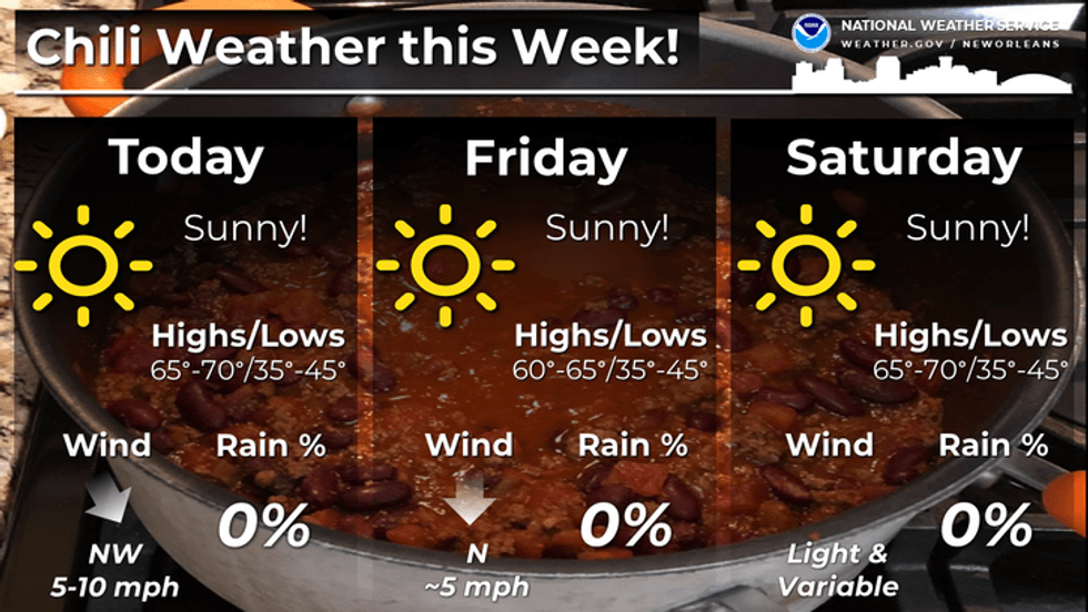
Detailed Forecast...
THURSDAY:
Colder AM. Sunny. Chilly PM. Breezy. High: 65. Winds: N/NW 8-15.
FRIDAY:
Sunny, chilly. Breezy. Low: S 48, N 38. Wind chill: 30s. High: 63.
SATURDAY:
Sunny, chilly. Some frost far north. Low: S 48, N 38. High: 67.
SUNDAY:
Mostly sunny. Warmer, slightly more humid. Becoming breezy. Low: S 53, N 45. High: 77.
MONDAY:
Sun to partly cloudy. Warmer, more humid. Breezy. Low: S 63, N 59. High: 79.
TUESDAY:
Mostly cloudy. 30% spotty showers, Milder temps. Low: S 65, N 61. High: 78.
WEDNESDAY:
Partly sunny. Mild. Low: S 60, N 52. High: 74.


