After a cold start to Saturday, we don't warm up much.
"Highs top out in the low 50s," WWL Chief Meteorologist Chris Franklin forecasts for Saturday and Sunday.
He says expect a light freeze and frost for the Northshore again Sunday.
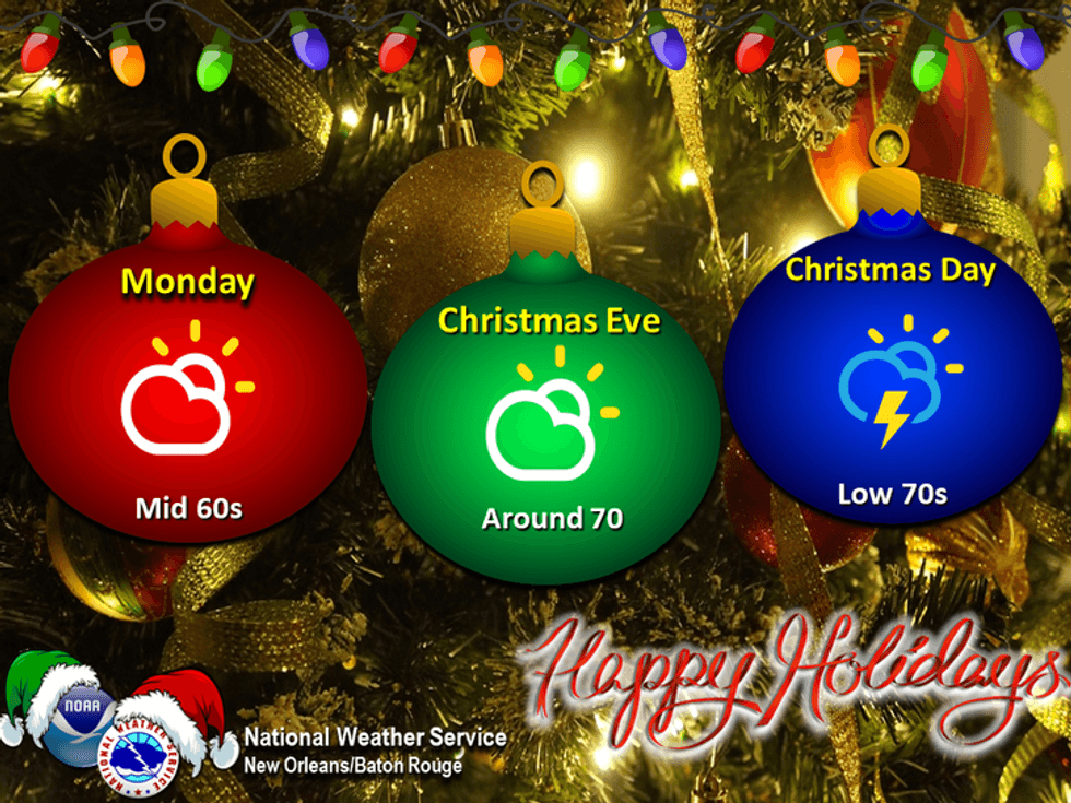
"A cool morning Monday, but no freeze and low to mid 60s by the afternoon."
Franklin says we will begin a warming trend as the cold air lifts back northward ahead of Christmas.
 NWS
NWS
"Right now, Christmas Day appears mild to warm with highs in the low 70s, some spotty showers, and a bit more humid."
Detailed Forecast...
TODAY:
Breezy early. Some early high clouds. Sunny and colder.
High: 53. Winds: N/NE 6-12.
SUNDAY:
Light freeze North. Frost River, northern Bayou. Sunny and chilly. Low: S 39, N 32. High: 57.
MONDAY:
Mostly sunny. Chilly morning, milder afternoon. Low: S 47, N 38. High: 65.
CHRISTMAS EVE:
Partly cloudy. Stray showers. Milder, bit more humid. Low: S 54, N 46. High: 70.
CHRISTMAS DAY:
Partly sunny. Spotty showers. Mild to warm, more humid. Low: S 59, N 54. High: 72.
THURSDAY:
Partly cloudy. Isolated shower. Warm. Low: S 58, N 55. High: 72.
FRIDAY:
Mostly cloudy. 40% scattered showers. Warm, humid. Breezy.
Low: S 60, N 57. High: 73.