A cold front has brought some dramatic changes to the weather across Southeast Louisiana.
"It's a cool and windy Tuesday morning, and it will stay cool and windy through the day," WWL TV Meteorologist Payton Malone said. "High temperatures will only climb to the low to mid-60s."
Temperatures were around 80 yesterday for afternoon highs.
Tomorrow morning will be even colder than today.
"Temperatures plunge, and we're looking near freezing Northshore and in MS," Malone forecasts. "A freeze Warning is currently in effect for late Tuesday or early Wednesday. Protect people, pets, and even some plants as we drop near freezing for a few hours. Pipes will be fine!"
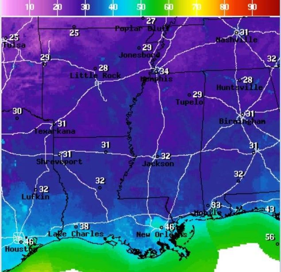 NWS
NWS
He says south of the lake, lows will be in the 40s.
"Plenty of sun on Wednesday with some staying in the upper 50s, and another cold morning by Thursday. Thursday afternoon will begin to see an increase in temperatures back to the upper 60s, then near 80° by Friday."
Detailed Forecast...
TODAY:
Early high clouds, then sunny. Chilly and breezy. High: 64. Winds: N 10-18.
WEDNESDAY:
A cold morning. Freezing North, MS. Chilly afternoon. Less wind. Low: S 47, N 34. High: 62.
THURSDAY:
A cold morning. Near freezing North, MS. Cool afternoon. Low: S 47, N 35. High: 68.
FRIDAY:
Chilly AM, milder afternoon. Mostly sunny. Low: S 54, N 45. High: 79.
SATURDAY:
Sun to partly cloudy. Milder temps, bit more humid. Turning breezy. Low: S 59, N 54. High: 80.
SUNDAY:
Partly cloudy. Warmer, more humid. Low: S 62, N 57. High: 82.
MONDAY:
Partly cloudy. Isolated shower. Warm, more humid. Low: S 67, N 65. High: 83.