It is hot now, but going to be even hotter this coming week.
WWL TV Meteorologist Alexa Trischler says today is actually going to be the least hot day over the next seven days.
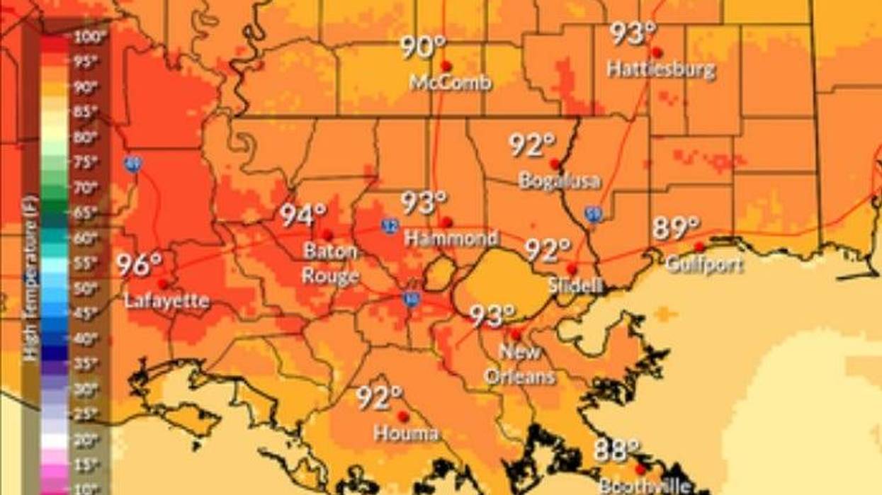
"The heat is expected to rise during the new work week!" she forecasts. "Sunday's high temperatures will be in the lower 90's with only isolated storm chances and humid conditions. Monday will offer similar weather with scattered rain and storms possible in the afternoon accompanied by a muggy-feel and high temperatures in the low 90's."
The increasing humidity will push feels-like readings well above the 100 mark.
"The rest of the week is when the heat and humidity really kicks into gear. Rain chances will also dip midweek, so any natural cooling mechanisms will be hard to come by without any showers around."
Trishler says high temperatures will likely climb to the mid to upper 90's.
"Humidity will also be on the rise so the heat index may be in the 100-108 degree range for much of the week."
Detailed Forecast...
SUNDAY:
Partly cloudy. Hot and humid. 20% chance of isolated showers and storms. High: 92.
MONDAY:
Partly cloudy. Hot and humid. 40% chance of scattered showers and storms. Low: S 76, N 71. High: 93.
TUESDAY:
Mostly sunny. Mostly dry. Hot, humid, and breezy. Low: S 76, N 72. High: 94.
WEDNESDAY:
Mostly sunny. Mostly dry. Hot, humid, and breezy. Low: S 78, N 73. High: 95.
THURSDAY:
30% chance of storms. Hot and humid. Low: S 79, N 73. High: 96.
FRIDAY:
30% chance of storms. Hot and humid. Low: S 79, N 74. High: 95.
SATURDAY:
30% chance of storms. Hot and humid. Low: S 79, N 73. High: 95.