


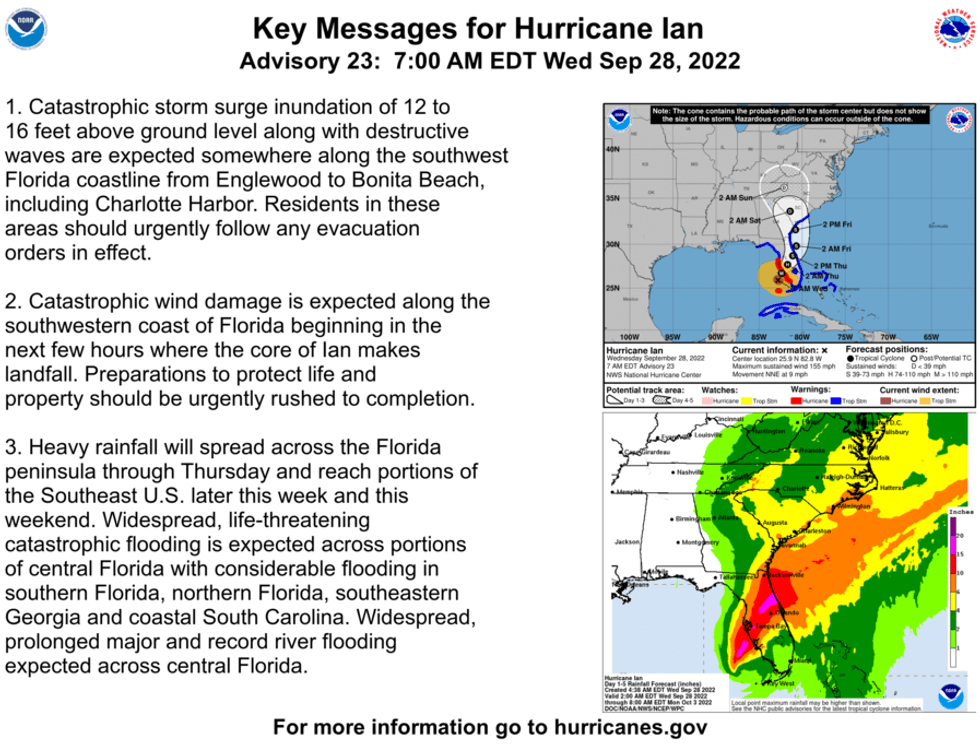
The National Hurricane Center says Hurricane Ian approached category five strength as it churned toward the Florida coast.
"There is a danger of life-threatening inundation, from rising water moving inland from the coastline," the Hurricane Center warned ahead of an expected storm surge of up to 16 feet.
The destructive 155 mph sustained winds and forecast up to 24 inches of rain are also expected to cause widespread damage to Central Florida.
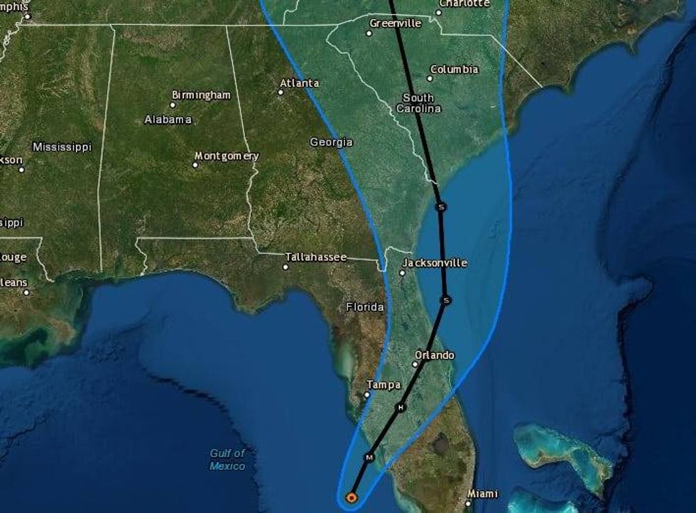
Landfall of the eye of the hurricane is expected between Sarasota and Cape Coral.
 NHC
NHC
"On the forecast track, the center of Ian is expected to approach the west coast of Florida within the hurricane warning area this morning, and move onshore later today. The center of Ian is forecast to move over central Florida tonight and Thursday morning and emerge over the western Atlantic by late Thursday."
Another landfall is forecast near the Georgia - South Carolina Friday. Ian is expected to be a tropical storm then.
 NHC
NHC


