Hurricane Ida has had a remarkably consistent track as its approached and entered the Gulf of Mexico over the past several days, but it had begun to wobble slightly to the east Saturday morning.

Such a shift isn't unusual, said meteorologist Ben Shot of the National Weather Service in Slidell, but it's important to watch as such a shift could significantly impact the areas hit with hurricane force winds that could be in excess of 130 miles per hour at landfall sometime Sunday evening.
"As it's trying to form the eye wall you get these big thunderstorms that blow up around the center of the eye wall. And sometimes those will pull it 20, 30 miles one way or another," Shot said on WWL Radio this morning. "When the eye wall continues to develop and becomes fully developed a lot of those wobbles will stop or really slow down. So it’s possible as it continues to really, really lock in that eye wall there could be a wobble in another direction."
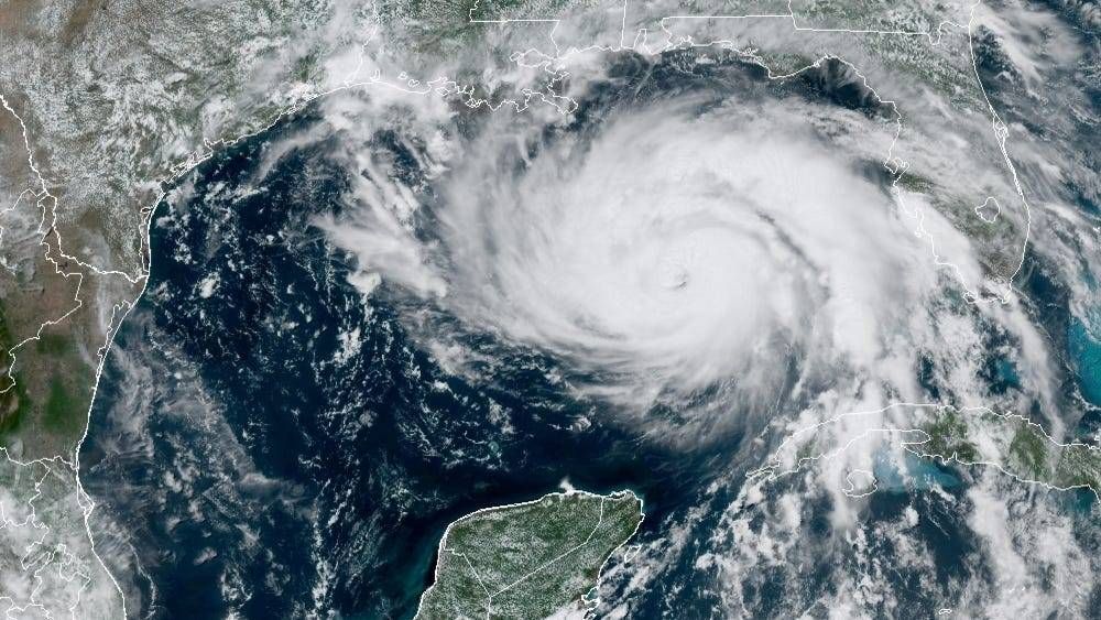
The storm is expected to intensify throughout the day as it moves through the warm waters of the Gulf of Mexico, and forecasters will be watching to see whether the wobble to the right is part of a larger trend of if it gets shifted back onto its track.
Regardless of where it landfalls, though, devastation is expected to follow with those high winds, life-threatening storm surge and up to 20 inches of rain in some parts of Louisiana.
“It’s going to be horrible. Your home is never going to look the same. Your neighborhood is never going to look the same. And that’s not hype," Shot said. "This is a strong [Category] 4 storm. It’s going to take an amazingly reinforced construction to survive Cat 4 winds along the coast, and if you have a chance to get out between now and when it starts to really impact us late tonight, I recommend you do. Don’t take the chance.”
New Orleans has issued a voluntary evacuation for areas within the levee system, but Mayor LaToya Cantrell said the storm was moving too quickly to coordinate a mandatory evacuation of metro areas. Areas outside the levee system had been ordered to evacuate.
South Louisiana was expected to begin experiencing tropical storm force winds in the early hours Sunday morning.
Listen to Shot's full interview in the player above, or click here.