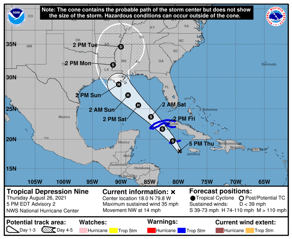
The National Hurricane Center says Tropical Storm Ida in the Caribbean is forecast to become a hurricane in the Gulf.
As of 4:20pm, forecasters said, "Air Force Reserve hurricane hunter aircraft data indicate that the depression has strengthened to Tropical Storm Ida. The maximum sustained winds are estimated to be 40 mph."
[shortcode-inline-related expand="1" link="/wwl/news/weather/gulf-is-absolutely-ripe-for-rapid-hurricane-intensification" headline="Governor: Gulf is "absolutely ripe" for rapid hurricane intensification" image="/media-library/image.jpg?id=64232538"]
"Steady strengthening is forecast during the next few days. (Ida) is expected to become... a hurricane when it is near western Cuba or over the southeastern Gulf of Mexico."
The Hurricane Center advisory says top winds are forecast at 110 miles per hour at landfall Sunday into Monday.
That would put it right at the top of category two strength. Forecasters say it could get stronger, though,
"The system could be near major hurricane strength when it approaches the northern Gulf coast."
The tropical storm is currently west of Jamaica.
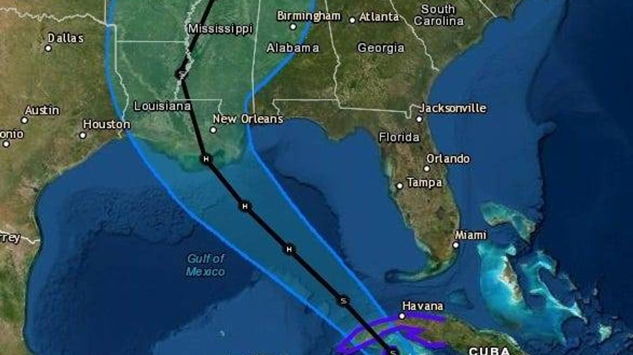
"On the forecast track, the center ... will pass near or over the Cayman Islands tonight, the Isle of Youth and western Cuba Friday, and over the southeastern and central Gulf of Mexico Friday night and Saturday. The system is forecast to approach the U.S. northern Gulf coast on Sunday."
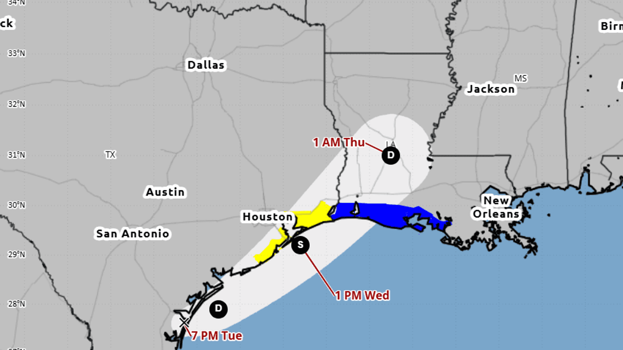
The forecast track now calls for the eye of the hurricane will come ashore over Houma, Louisiana on a path for Baton Rouge.
This is a shift east of the last forecast. It could change again as the Hurricane Center awaits data from a Hurricane Hunter aircraft flying in the system.
"The (storm) may begin to bring rainfall and potential flooding impacts to the central Gulf Coast by early Sunday."