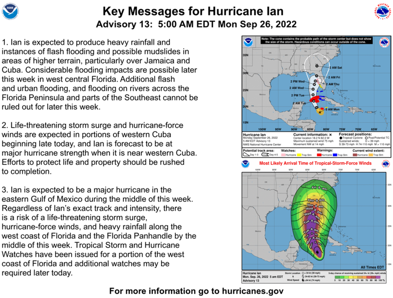

Hurricane Ian is forecast to become a category four storm in the Gulf of Mexico this week as it takes aim at Florida. Sustained winds are forecast to grow to 140 mph with higher gusts.
"Rapid strengthening is expected during the next day or so, and Ian is forecast to become a major hurricane tonight when it is near western Cuba," the National Hurricane Center advised.
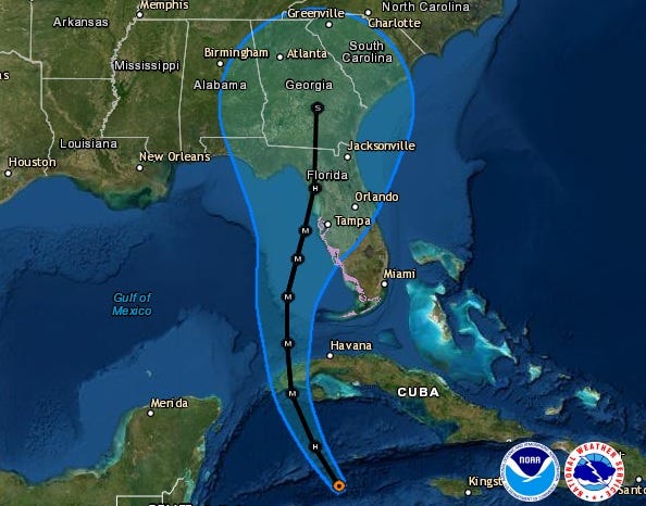
Ian is currently in the Caribbean.
"On the forecast track, the center of Ian is expected to pass near or west of the Cayman Islands today, and near or over western Cuba tonight and early Tuesday. Ian will then emerge over the southeastern Gulf of Mexico on Tuesday, and pass west of the Florida Keys late Tuesday, and approach the west coast of Florida on Wednesday."
With intense winds, surge and rain... much of the Florida peninsula, Florida Keys and Cuba are expected to experience Ian's impact.
Surge along the Florida Gulf Coast is expected to be as much as eight feet, with a 14 foot surge in Cuba.
WWL TV Meteorologist Payton Malone says, "Right now there are no tropical impacts expected for Louisiana and Mississippi aside from swells off the coast next week and a north wind Wednesday through Friday."