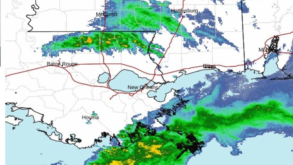
Seriously colder conditions are on tap after heavy rain early this morning.
"Tonight, will be much colder as temperatures drop into the 30s and wind chills drop into the 20s," WWL TV Meteorologist Payton Malone forecasts.
He says by Friday morning, it will be 25 to 30 degrees colder, with freezes north of the lake and 30s on the Southshore.
"We don't warm up a lot Friday as temperatures stay in the low 50s. Luckily there will be some sun Friday afternoon."
After that?
"The weekend starts off cool with Saturday's high in the upper 50s, but we return to the 70s Sunday ahead of multiple storm systems."
Detailed Forecast...
TODAY:
100% morning rain, few storms. Rain ends mid-morning. Mild early, then falling temps. Breezy. High: 64, then falling. Winds: S/N 8-15.
FRIDAY:
Light freeze/frost North. Early sun, late clouds. Breezy and chilly. Low: S 38, N 30. High: 52.
SATURDAY:
Light freeze/frost North. Mostly cloudy. Spotty showers.
Cool, breezy. Lows: S 43, N 34. High: 58.
SUNDAY:
Cool morning, rapid warm up. Mostly cloudy. 50% rain and storms late. Low: S 54, N 48. High: 72.
MONDAY:
70% morning, midday rain and storms. Mostly cloudy. Warm, breezy. Low: S 65, N 62. High: 73.
TUESDAY:
Mostly cloudy. 50% scattered showers late, more overnight.
Warm. Low: S 62, N 58. High: 70.
WEDNESDAY:
70% AM rain, then ending. Falling temps. Turning windy. Low Near Midnight: S 47, N 44. High: 61, then falling.