
Today is forecast to be even hotter than the intense heat we've been seeing for weeks.
"Record highs are sure to be broken at several locations," the National Weather Service office for New Orleans posted. "Please be careful outdoors!"
The record high ever at the official recording location at New Orleans Armstrong International Airport is 102 degrees, set in 1980.
WWL TV Meteorologist Payton Malone said, "Temperatures could climb to all-time record levels. The temperature is forecast to reach around 102..which is the all-time record high set at MSY on August 22, 1980."
Some computer models are forecasting up to 104 degrees for today's high.
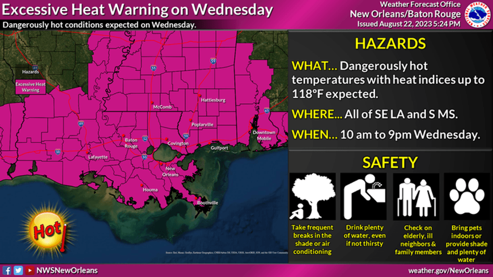
"The oppressive heat will continue with another Excessive Heat Warning for the entire area. Heat Index values will be up to 118 degrees! Try to drink plenty of water and make sure to take breaks in the shade, or in an air conditioned room if possible," the Weather Service said.
 NWS
NWS
Here is Malone's detailed forecast
TODAY:
Record heat! Mostly sunny. Hot, humid. High: 102. Winds: Light.
THURSDAY:
Mostly sunny. Hot, humid. Low: S 83, N 80. High: 100.
FRIDAY:
Partly cloudy. 20% isolated showers, storms. Hot and humid. Low: S 83, N 80. High: 100.
SATURDAY:
Partly cloudy. 20% isolated showers, storms. Hot and humid. Low: S 83, N 80. High: 100.
SUNDAY:
Partly cloudy. 20% isolated showers, storms. Hot and humid. Low: S 82, N 79. High: 100.
MONDAY:
Partly sunny. 30% spotty showers, storms. Hot and humid. Low: S 82, N 79. High: 100.
TUESDAY:
Partly sunny. 30% spotty showers, storms. Hot and humid. Low: S 82, N 79. High: 98.