


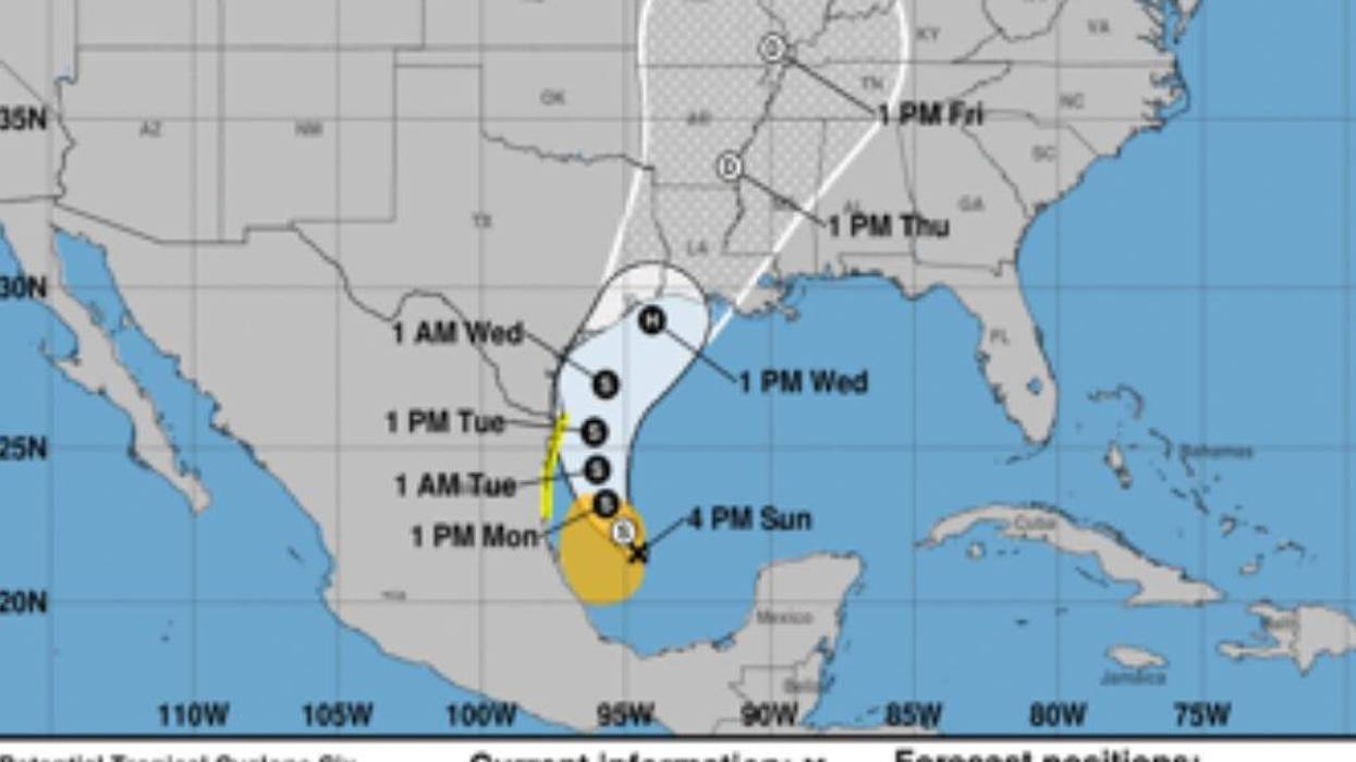
The National Hurricane Center says the possible tropical cyclone in the Bay of Campeche will develop into a Category 1 hurricane before making landfall in Cameron Parish on Wednesday night.
The NHC issued its first forecast track and cone of uncertainty for the storm on Sunday afternoon. The track shows the eye of the storm making landfall just along the Louisiana/Texas state line around 10 p.m. Wednesday. The cone of uncertainty stretches from Houston on the west side to St. John Parish on the eastern edge.
Although hurricane hunters found maximum sustained winds of 50 miles per hour while investigating the storm, the system does not yet have a defined center of circulation. As such, the NHC has not declared the system to be a tropical storm. However, that designation could come either Monday or Tuesday as the center of circulation becomes defined.
The system is expected to bring heavy rainfall and storm surge to coastal Louisiana. NHC forecasters urge residents of southern Louisiana to have a hurricane plan in place ahead of the storm’s landfall.
Parts of the Mexico and Texas coasts are under tropical storm watches and warnings. Further warnings for the northern Gulf Coast, including for the Louisiana coast, will be issued in the next two days.


