


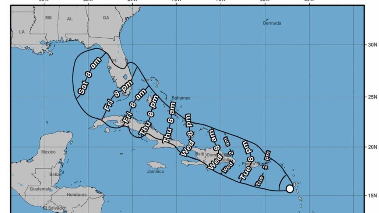

Forecasters with the National Hurricane Center anticipate the tropical disturbance in the Atlantic could form into Tropical Storm Fred today.
Forecasters say the storm could strengthen and approach south Florida by this weekend.
The storm is currently 105 miles west of Guadeloupe and 270 miles east-southeast of Puerto Rico and heading west-northwest towards the Dominican Republic.
Below is a NHC forecast:
At 800 AM AST (1200 UTC), the disturbance was centered near latitude
16.0 North, longitude 63.1 West. The system is moving toward the
west-northwest near 17 mph (28 km/h) and this general motion is
expected to continue during the next few days. On the forecast
track, the disturbance is expected to pass near or over the U.S.
Virgin Islands and Puerto Rico late today and tonight, and be near
or over Hispaniola on Wednesday.
Maximum sustained winds remain near 35 mph (55 km/h) with higher
gusts. Gradual strengthening is forecast during the next day or so
and the disturbance is expected to become a tropical storm later
this morning. Some weakening is likely while the system interacts
with Hispaniola on Wednesday. A NOAA Hurricane Hunter aircraft is
currently enroute to investigate the disturbance.
* Formation chance through 48 hours... high...90 percent.
* Formation chance through 5 days...high...90 percent.