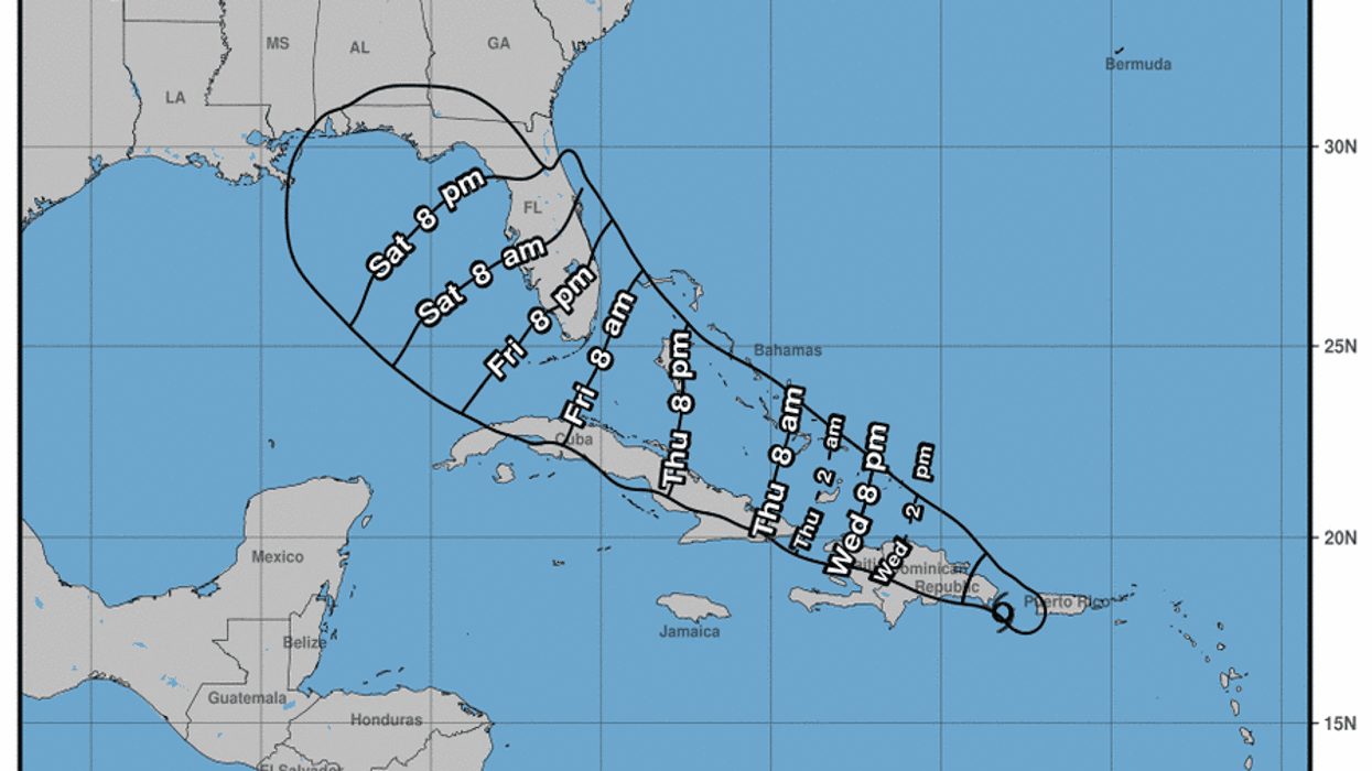
The tropical disturbance in the Atlantic has formed into Tropical Storm Fred and is heading the Dominican Republic and is expected to enter the Gulf of Mexico by Saturday.
It is currently 115 miles east-southeast of Santo Domingo with maximum winds of 40 miles per hour.
The National Hurricane Center’s Hurricane Hunters confirmed the formation.
Below is the latest from NHC:
At 500 AM AST (0900 UTC), the center of Tropical Storm Fred was
located near latitude 18.0 North, longitude 68.2 West. Fred is
moving toward the west-northwest near 16 mph (26 km/h), and a
general west-northwestward motion is expected to begin later today
and continue for the next few days. On the forecast track, the
center of Fred is expected to be near or over Hispaniola later
today, move near the Turks and Caicos Islands and the southeastern
Bahamas on Thursday, and move north of the northern coast of central
Cuba on Friday.
Maximum sustained winds are near 40 mph (65 km/h) with higher gusts.
Some weakening is likely while the system interacts with Hispaniola
later today.
Tropical-storm-force winds extend outward up to 45 miles (75 km)
from the center.