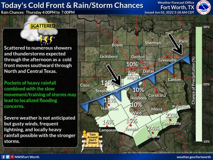
In case you haven't looked outside this morning, very heavy rain continues to press through north Texas out ahead of a cold front. Good news is, welcome rain is falling across the entire area. More good news, none of this has been severe! However, there have been some 50 to 60 mph wind gusts between 4 and 5:30 this morning across parts of north Texas. Plus, we haven't had any hail or damaging wind reports.
Average rainfall totals will be between a half inch to 2 and a half inches across north Texas, with the heaviest rain along and east of the Central Expressway to Interstate 45 line... Through 7am. There are some Urban Flood Advisories in effect for Wise, Denton, and Collin counties through mid morning due to the rain we had yesterday combined with the rain in this morning. As we work our way through mid-morning, this area of rain will press southeast of the Dallas-Fort Worth area.
A cold front will move through the area mid-to-late morning ushering in cooler drier air and allowing the skies to clear slowly from northwest to southeast. Afternoon highs today will struggle to hit 80° with a north wind at 15 to 25 mph. Overnight lows tonight will drop into the mid-to-upper 60s.

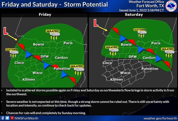
I've got more good news, two more upper-level disturbances will keep rain chances in our forecast through Saturday late morning. First chance of rain will be during the late morning and afternoon tomorrow, the next chance of rain will arrive into early Saturday morning. These storms will form well to the northwest of us, but weaken significantly as they move into the area both days.
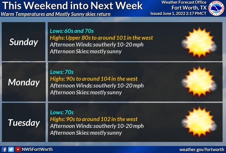
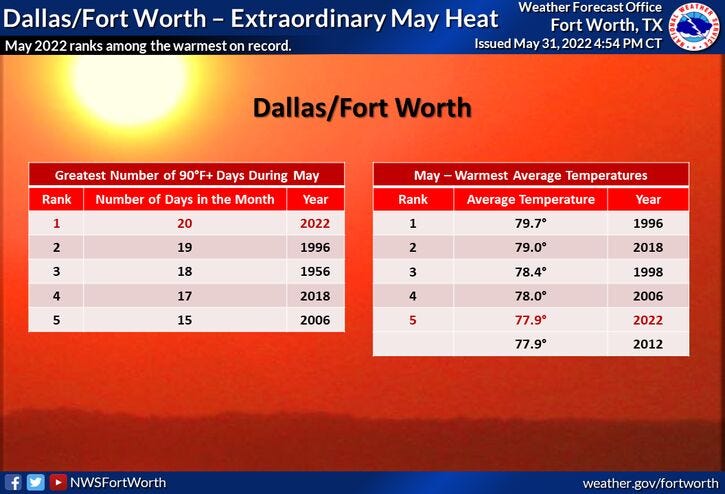
Afternoon highs tomorrow will be in the low 80s, near 90 degrees on Saturday, low to mid-90s on Sunday, then we really dry out and heat up in the next week... with highs in the mid-to-upper 90s. Heat index values will be above 100 degrees.

*Yest Rain: 2.15”; *Yest High: 89; Low: 71
*Today’s Averages: High: 89; Low: 70
*Record high: 104 (1910); Record low: 52 (1919)
* June rain: 2.15”; June surplus: +1.63”
*2022 rain: 11.92”; 2022 deficit: 4.80"
*Sunrise: 6:20am; Sunset: 8:32pm

Today: Morning strong storms, afternoon sun. Breezy and cooler. High: Near 80. Wind: North 10-15 mph.
Tonight: Partly cloudy and mild. An Isolated shower. Low: 65-70. Wind: NE 5-10 mph.
Tomorrow: Partly cloudy and warm. Scattered afternoon and evening storms. High: Mid 80s. Wind: ENE 5-10 mph.
Friday: Partly cloudy. Slight chance for showers and storms. High: Mid 80s.
Saturday: Scattered morning storms, afternoon sunshine. Warmer. High: Near 90.
Sunday: Isolated morning storms, afternoon sunshine. Windy and hot. Highs: Mid 90s.
Monday - Wednesday: Sunny, windy, hot and humid. Highs: Mid to upper 90s. Lows in the 70s.
LISTEN on the Audacy App
Sign Up and Follow NewsRadio 1080 KRLD

