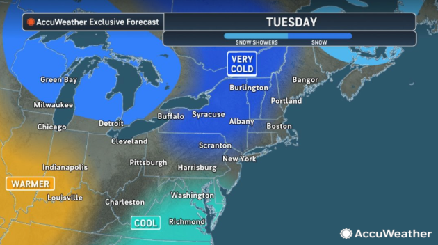

Buffalo, N.Y. (WBEN) - It sure feels like winter in Western New York Tuesday, with temperatures in the teens to start the day and not expected to get much past 20 degrees as we await yet another weather system that will bring widespread snow across the Western New York region into Wednesday.
A Winter Weather Advisory is posted for southern Erie, Wyoming, Chautauqua and Cattaraugus counties from Tuesday evening through Wednesday afternoon.
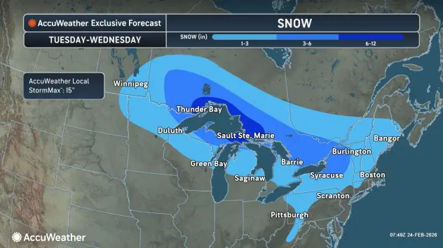
"We're going to get another round of widespread light to moderate snow across Western New York," National Weather Service meteorologist Heather Kenyon tells WBEN. "Most of it's going to fall overnight, but most areas could pick up 2 to 4 inches, and then the higher terrain could see up to 6 inches."
Throughout the day Tuesday, there will be some light lake effect snow showers across portions of the Buffalo-Niagara region that will taper off as the day progresses and end completely before the widespread area of snow moves in.
"We're expecting it to move in after 8 p.m. tonight," Kenyon predicts. "Right off the bat it's going to be light to moderate, so we could see visibility drop down across the region."
After some just light snowfall during the day Wednesday, Thursday should be mainly snow-free. "Into the weekend it looks mostly dry," Kenyon notes.
No big warmup is in the forecast, but we will see temperatures rise above the freezing mark. "Tomorrow, on Wednesday, we'll likely see the low to mid 30's," Kenyon says.
And for the weekend, temps are expected to near 40 degrees.
Related

WINTER WEATHER ADVISORY REMAINS IN EFFECT FROM 7 PM THIS EVENING TO 1 PM EST WEDNESDAY
...WINTER WEATHER ADVISORY IS CANCELLED...
* WHAT...Snow expected Total snow accumulations 3 to 5 inches with the greatest accumulation on the higher terrain.
* WHERE...Wyoming, Cattaraugus, and Southern Erie Counties. The greatest accumulations will be across the higher terrain.
* WHEN...From 7 PM this evening to 1 PM EST Wednesday.
* IMPACTS...Plan on snow covered and slippery road conditions.
PRECAUTIONARY/PREPAREDNESS ACTIONS...
Periods of snow will result in snow covered roads and limited visibilities. Slow down and use caution while driving.