


NEW YORK (1010 WINS) -- Heavy thunderstorms are bringing flooding downpours and damaging wind gusts to the New York City area on Monday, with a Tornado Watch even issued for parts of New Jersey.
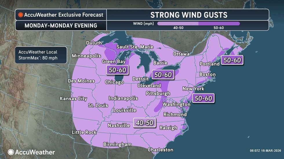
The National Weather Service issued a Wind Advisory for most of the Tri-State from 2 p.m. Monday to 4 a.m. Tuesday. Winds of 20 to 30 mph, and wind gusts of up to 50 mph, are expected as severe weather sweeps across the East Coast.
The NWS issued a Tornado Watch until 7 p.m. for the following 16 counties in New Jersey: Atlantic, Burlington, Camden, Cape May, Cumberland, Gloucester, Hunterdon, Mercer, Middlesex, Monmouth, Morris, Ocean, Salem, Somerset, Sussex, and Warren.
"Gusty winds will blow around unsecured objects," NWS warned. "Tree limbs could be blown down, and a few power outages may result. Low visibility could make driving conditions hazardous."
 Heavy rain and winds are expected in NYC on Monday.Adam Gray/Getty Images
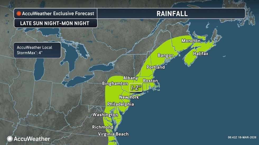
According to AccuWeather, it will feel more like April on Monday, with highs reaching 61 degrees by afternoon. But the warmup will also come with springlike showers and storms.
Conditions will be cloudy, very windy and soaking wet throughout the day, with the heaviest storms expected late afternoon into the evening. Winds will continue into Monday night as temps turn sharply colder.
 AccuWeather
The storm will move out for St. Patrick's Day festivities on Tuesday, but it will be blustery and cold with a high of 41. People heading to the parade on Fifth Avenue should be greeted by partly sunny skies.
Highs are forecast to stick to the 40s on Wednesday and Thursday.
 AccuWeather


