NEW YORK (1010 WINS) — New York City is bracing for another quick-moving storm that's going to bring another wintery mix weekend ahead.
New York City can expect rainy conditions Friday night, according to AccuWeather. North and west of the city, the weather will change overnight to wet snow, which could make travel dangerous.
The rain will likely mix with or even change to snow in the city and nearby suburbs closer to daybreak and into Saturday morning. The low is 34.
The snow, still mixed with rain in some areas near the coast, will continue into Saturday morning before ending. Watch for slushy and slippery travel early, especially north and west of the city.
AccuWeather predicts accumulations of a slushy coating up to an inch in the city and close-by coastal suburbs, 1-3 inches in most inland suburbs north of I-78 and possibly 3-6 inches north and west of 287.
Roads and sidewalks can be slushy to slippery for the inland suburbs, mainly wet for the city and coastal suburbs.
New Yorkers could anticipate a chilly breeze and mostly cloudy skies for the remainder of Saturday. The high is 44.
By Saturday night, conditions will be clear. The low will be 32 in the city, 20s in most suburbs.
There will be a lot of sunshine on Sunday, followed by increasing clouds, though it won't be as chilly. The high is 47.
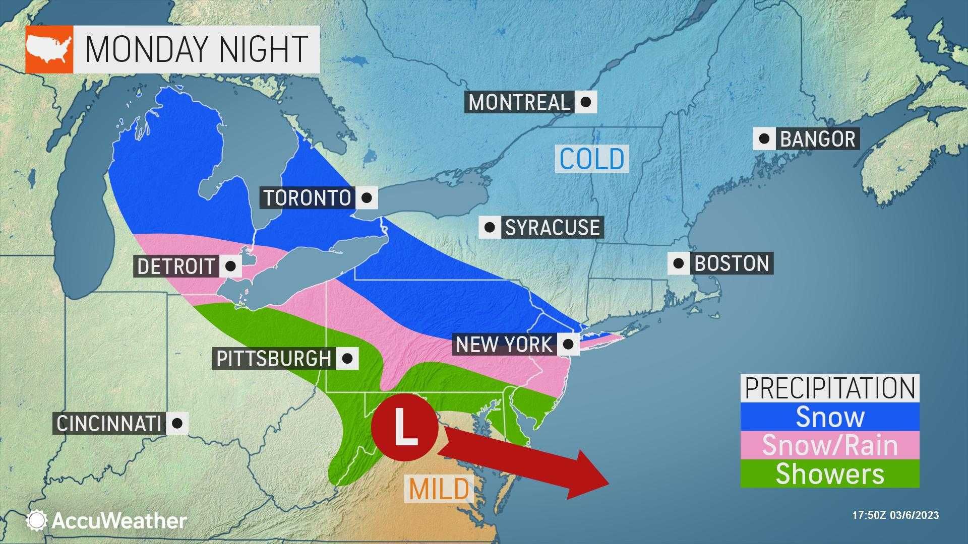
Another coastal storm is predicted by AccuWeather for Monday into Tuesday, bringing wind, rain, and some snow to the region with the best chances for accumulation in the inland suburbs. Coastal flooding is likely.
Monday's high is 44, while Tuesday's is 42.
 AccuWeather