


NEW YORK (1010 WINS) -- Severe weather—including the threat of flash flooding—is in the forecast for the entire New York City area from Thursday into Friday, forecasters warned as New York and New Jersey declared a states of emergency. The New York state of emergency impacts the entire NYC area.
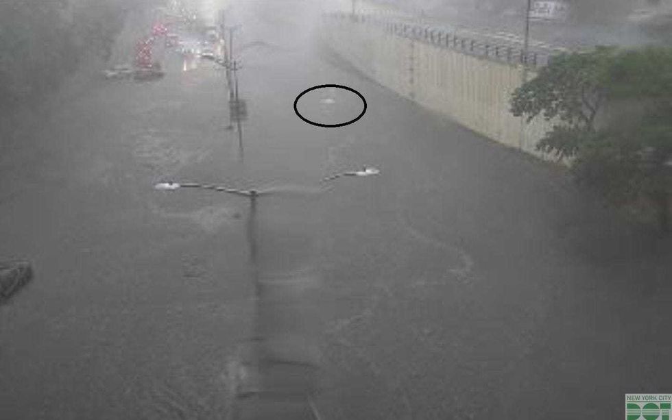 The Clearview Expressway at Northern Boulevard was flooded by 3 p.m. Thursday after inches of rain fell in northern Queens.NYC DOT
Here's what to know:
• The National Weather Service has issued a Flash Flood Warning for a swath of the area that includes parts of NYC, Long Island and North Jersey. Rain could fall at a rate of 2-3 inches per hour. A Severe Thunderstorm Warning was also issued for parts of New Jersey and NYC, among other alerts. A Flood Watch is still in effect until Friday morning.
 AccuWeather
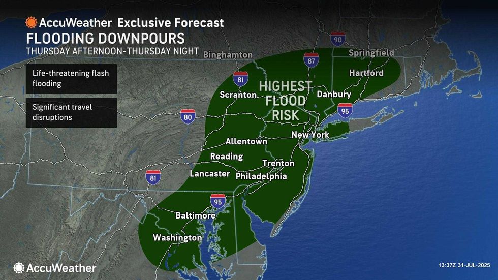
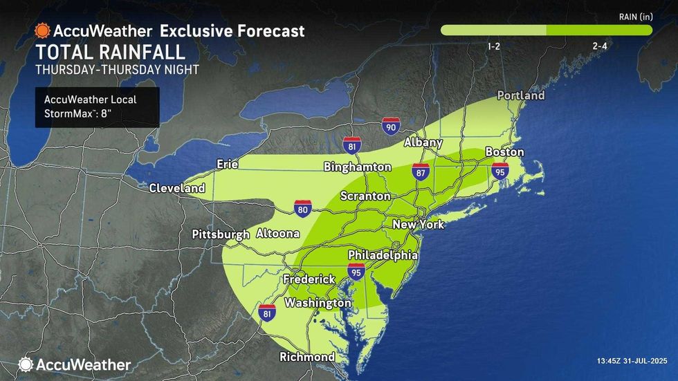
• Significant flooding is possible starting Thursday afternoon through Friday afternoon, including the risk of flash flooding. Heavy winds and lightning are also possible. The storm system comes just two weeks after Central Park recorded its second-highest one-hour rainfall total on July 14.
• According to AccuWeather, tropical torrential downpours will become more widespread throughout the evening and could cause significant flooding and travel disruptions. Rain will continue into Friday, when the high will only be 72—much cooler than the 100-degree heat indices seen earlier this week.
 AccuWeather
• In New York, Gov. Kathy Hochul declared a state of emergency and ordered state agencies to prepare for the severe weather, which will impact a huge swath of the state stretching across NYC, Long Island and the Hudson Valley. Hochul told WINS Thursday that New Yorkers should not "be complacent" and that this is a "very serious" storm. The MTA is ready to respond to possible flooding in the subway system. New York City issued a Travel Advisory for Thursday and Friday.
• New Jersey, which experienced deadly flooding during a major rainstorm a couple weeks ago, declared a state of emergency starting Thursday afternoon. Acting Governor Tahesha Way warned localized rainfall of up to 7 inches was possible in the state.


