NEW YORK (1010 WINS/WCBS 880) – Another round of showers and storms is possible in New York City on Thursday—and even more severe weather may impact the northern suburbs—after a powerful coastal system slammed the Tri-State Wednesday, leaving one person dead and thousands without power.
Power was still being restored to more than 15,000 Con Edison customers in Westchester and the five boroughs at daybreak Thursday following Wednesday's wet and windy weather. At the height of the storm, power was knocked out to some 25,000 customers in Westchester alone, while another 15,000 outages were reported by JCP&L in New Jersey.
The storm also brought down more than 100 trees in New York City, causing damage but no serious injuries. It was a different story in Westchester, where a woman was killed when a tree fell on her car in Armonk.
 AccuWeather
 AccuWeather
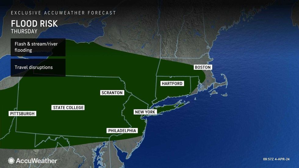
And in New Jersey, the Passaic River continued to rise after 2–3.5 inches of rain fell across much of the Tri-State. Among the hardest hit areas was Hillsdale in Bergen County, where 3.58 inches of rain was recorded by 9 p.m. Wednesday. In NYC, nearly 3 inches of rain was clocked in parts of Brooklyn and southern Queens.
Minor to moderate flooding was expected along the Passaic from Paterson to Little Falls going into the weekend. The river was set to be a foot above flood stage Thursday.
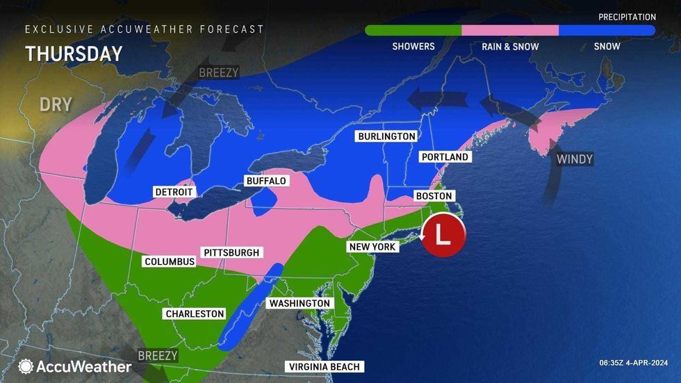
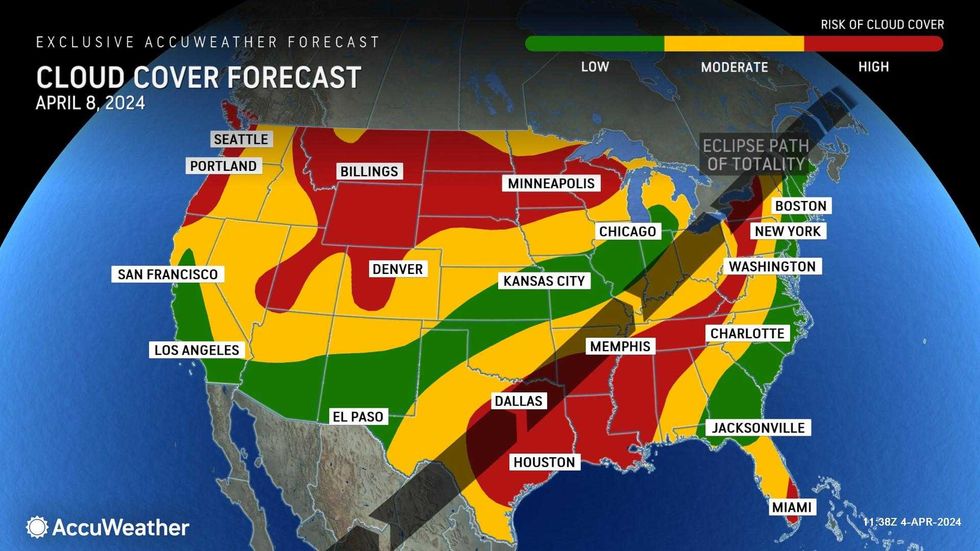
The flooding rains and destructive winds had departed the New York area by Thursday, but some leftover rain will pop up to end the workweek before conditions clear for the big eclipse on Monday, according to AccuWeather.
 AccuWeather
 AccuWeather
Thursday's weather won't be nearly as wild in the city, but gusty showers are possible in the afternoon, along with a potential for thunder and hail. Areas north of the I-287 corridor have a higher chance of experiencing more severe weather.
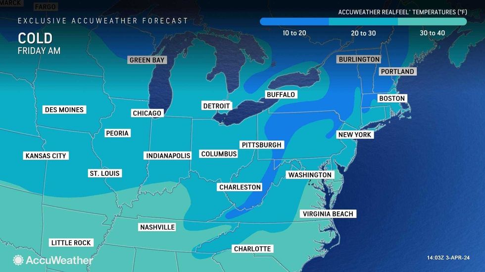
It will remain chilly for April, with highs near 50 degrees and RealFeels in the 30s with a gusty breeze.
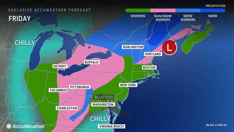
Friday will be brisk and chilly with showers in spots, mainly in the afternoon. Temps will be about 45 degrees for first pitch at the Yankees' home opener in the Bronx. The high for the day will be 49, but RealFeels will stick mostly to the 30s.
Another shower can't be ruled out Saturday, when it will otherwise be chilly with a high of 52.
The weather will begin to improve by Sunday. Expect a mix of sun and clouds and a high of 56.
Conditions continue to look good for Monday afternoon's historic solar eclipse. The forecast shows clear skies with highs in the mid-60s.
 AccuWeather