


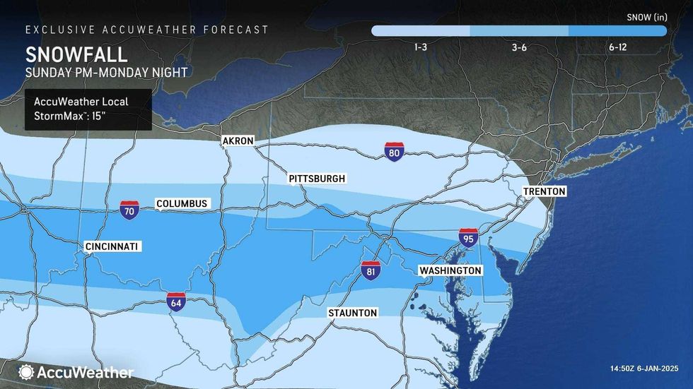
NEW YORK (1010 WINS) – New York City was hammered with moderate snow and brutal cold Monday as a polar vortex and an ice storm slammed the East Coast.
A coating to 1 inch of snow was forecasted for the five boroughs, North Jersey and Long Island, while 1 to 3 inches were possible further south in New Jersey, according to AccuWeather.
While the bulk of the precipitation was south of the metro, there was enough to cause slippery roads and sidewalks, as Monday's high only reaches 32 degrees in Manhattan.
 A person walks along a sidewalk in Fort Hamilton, Brooklyn, on Jan. 6, 2025.CHARLY TRIBALLEAU/AFP via Getty Images
 A jogger runs at Jacqueline Kennedy Onassis Reservoir in Central Park on Jan. 6, 2025.TIMOTHY A. CLARY/AFP via Getty Images
The wild weather was causing major issues at New York's three main airports, with well over 200 delays each at LaGuardia, JFK and Newark airports. Dozens more flights were canceled outright.
"Whatever amount of snow we get, one thing's for certain: it's going to be incredibly cold," Mayor Eric Adams posted on X, warning New Yorkers to layer up clothing and contact 311 if they see anyone in need of shelter. A Code Blue is in effect to get unhoused people off the streets and out of the cold.
 AccuWeather
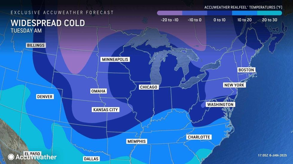
Tuesday night will be increasingly windy and cold as the low dips to 23 in the city and RealFeels plunge into the single digits overnight.
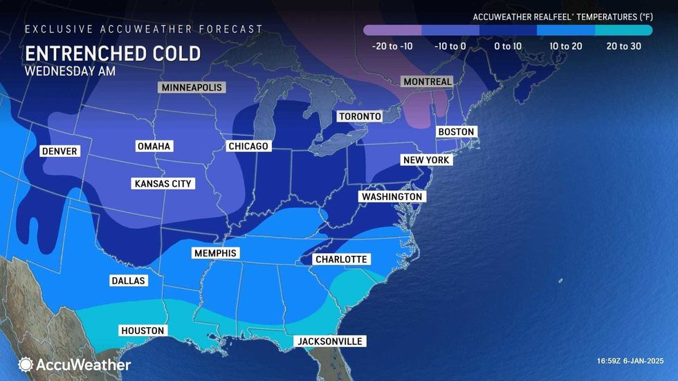
The blustery cold returns Tuesday and sticks around for the rest of the workweek. While it will be sunny or partly sunny most days, highs will struggle to get above the freezing mark. The wind chill will be dangerous.
 AccuWeather
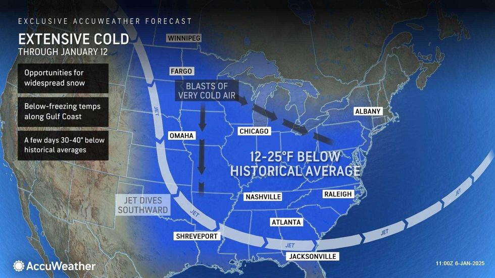
The polar vortex dipped south over the weekend and spread cold from the Rocky Mountains to the Atlantic, making many roads treacherous, forcing school closures, and causing widespread power outages and flight cancellations.
The polar vortex of ultra-cold air usually spins around the North Pole, but it sometimes escapes and plunges southward into the U.S.
 AccuWeather
 AccuWeather


