NEW YORK (1010 WINS/WCBS 880) – Central Park broke its record snowless streak on Tuesday as a winter storm brought snow and ice to the New York City area ahead of extremely cold weather Wednesday.
The park recorded 1.4 inches of snow between midnight and 7 a.m. Tuesday, according to the National Weather Service. Other snowfall totals included 2.2 inches in Whitestone, Queens and 3 inches in Levittown and Mount Sinai on Long Island.
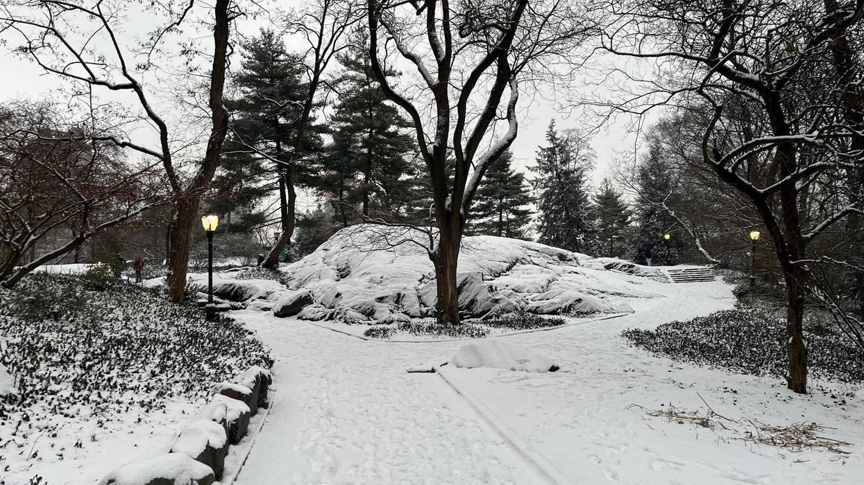
The last time the city saw an inch of snow was on Feb. 13, 2022, when 1.4 inches was measured in Central Park. That was 700 days ago on Sunday. See photos of Tuesday's snow in Central Park.
The snow drought was the longest the park had gone without an inch of the white stuff in a single day since record-keeping started in 1869. The previous record was 383 days, ending in March 1998.
Most of the metro area, including all of New York City was under a Winter Weather Advisory until Tuesday evening. The city put down 40 million pounds of salt to keep the roads clear ahead of the season's first significant snow.
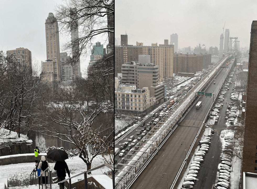 More than an inch of snow fell on the city Monday night into Tuesday.Glenn Schuck/Kimberly Dole
About 2 to 4 inches of snow were set to fall across the city by day's end. Manhattan, the Bronx and Staten Island were expected to see a bit more—3 to 4 inches—than Brooklyn and Queens, which were in the range of 1 to 2 inches.
Upwards of 4 inches was expected north of the I-287 corridor in the Hudson Valley.
A changeover to sleet and rain threatened icy conditions for the evening commute as temps begin to plunge going into Tuesday night.
 AccuWeather
 AccuWeather
Tuesday ends very cold as skies clear. The low in the city will be 19 degrees overnight, with RealFeels near 0 degrees.
Looking ahead, Wednesday will be sunny but very cold. The high will be 27, but RealFeels will be in the teens.
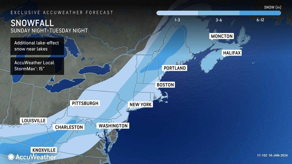
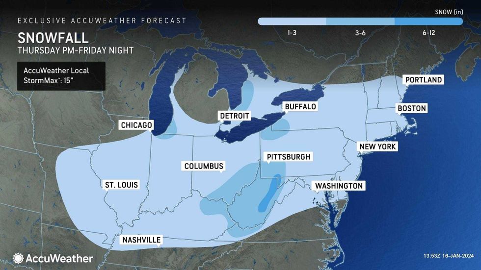
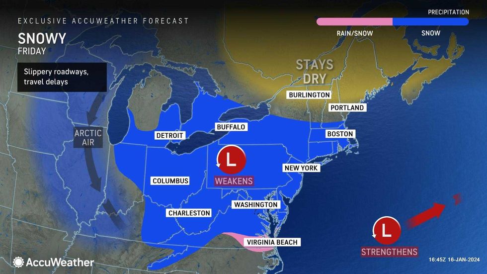
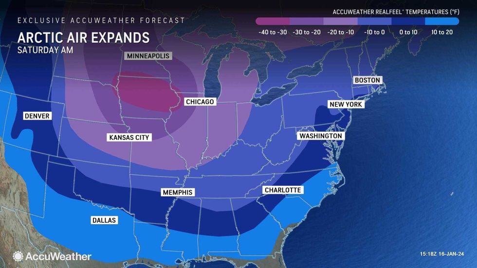
Another round of snow is expected to bring 1 to 2 inches of accumulation Thursday night into Friday. And a bit more snow may fall early Saturday as a polar vortex conditions continues to push temps down.
 AccuWeather
 AccuWeather
 AccuWeather