


NEW YORK (1010 WINS/WCBS 880) — New York City activated its Heat Emergency Plan for a record 23rd day this summer on Sunday, highlighting the growing effect of extreme heat on the city, as showers persist in the area following Saturday night's thunderstorms.
"We've been now activated over 20 days this year alone for heat. That's significantly more than we have in years past," NYC Emergency Management Commissioner Zach Iscol told 1010 WINS on Saturday. "I'll just say I'm very proud of the team and the work that they're doing to safeguard New Yorkers during these periods of high heat."
To help beat the heat, local officials remind New Yorkers that cooling centers are open across the city for those who may not have access to air conditioning. They can be located by calling 311 or accessing the city's Cool Options Map.
The Heat Activation Plan is in place through Monday, which is expected to hit a high of 91, according to AccuWeather.
"Take advantage of cool places," Iscol said. "Reach out to friends who might be older adults or represent vulnerable populations. Make sure that they're doing okay, or make sure they get to a cool place."
While swimming at local beaches is still restricted to 10 a.m. through 6 p.m. daily, the city has extended lifeguard hours through 8 p.m. as part of its heat plan.
This is especially prudent as a High Rip Current Risk is in effect Sunday and Monday, meaning that "Life-threatening rip currents are likely for all people entering the surf zone," according to the National Weather Service.
But despite concerns regarding extreme heat, stormy weather continues to plague the Tri-State area, following severe thunderstorms on Saturday night.
The storms caused a headache for airlines on Saturday as hundreds of flights out of the three main NYC-area airports were delayed or canceled, and this pattern has continued Sunday.
As of 9 a.m., there have been 62 delays and 124 cancellations out of LaGuardia Airport, 124 delays and 96 cancellations out of John F. Kennedy International Airport and 111 delays and 76 cancellations out of Newark Liberty International Airport.
 AccuWeather
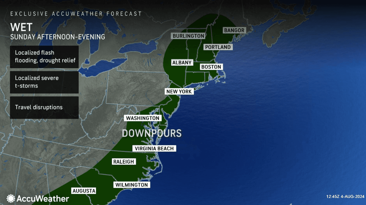
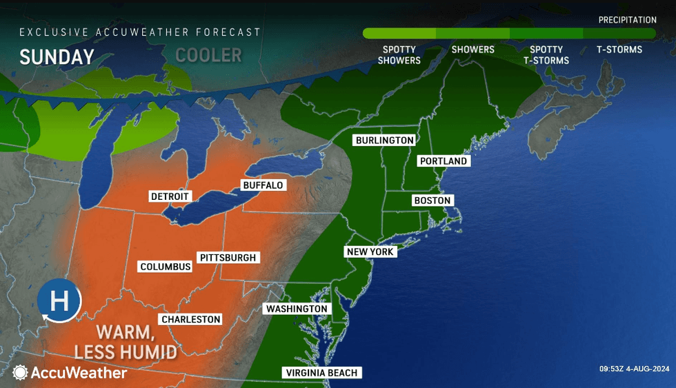
Sunday afternoon is expected to be cloudy, warm and humid with showers and a heavy, gusty thunderstorm later, AccuWeather said. Ponding on roads is possible.
A lingering early-evening thunderstorm will hit, and it will remain humid with clouds breaking late. The low will be 73, dropping 10 degrees from the daytime high of 83.
 AccuWeather
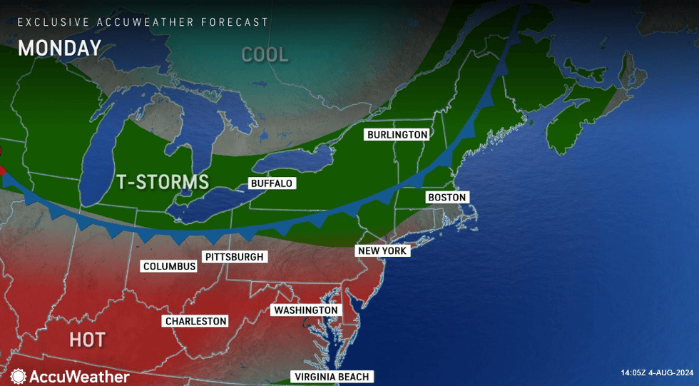
Monday will be sunny to partly cloudy, and the hot and humid day will reach 91 on the 24th activation of the city's Heat Emergency Plan.
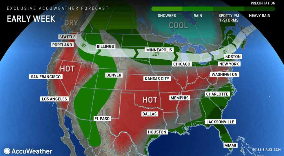
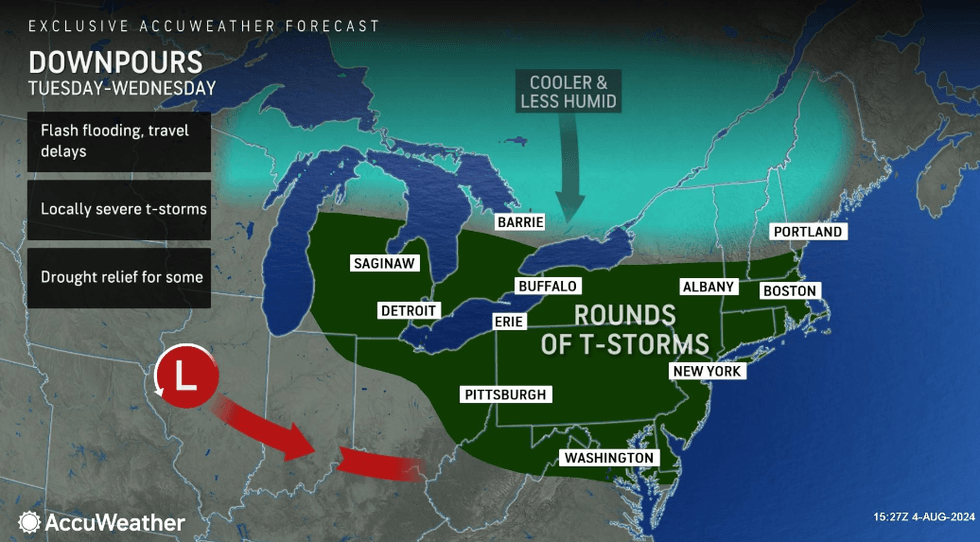
AccuWeather says the heat stretch will break on Tuesday and the city will continue to cool through the week. It will be mostly cloudy and humid with showers and a thunderstorm or two hitting in the afternoon and night. The high will be 84.
 AccuWeather
 AccuWeather
The humidity will continue through Wednesday, with a cooler high of 75. Thunderstorms and showers will hit yet again, especially south of the city.
Thursday will finally reclaim some sunshine, AccuWeather said, though it will stay cool with highs in the mid-70s.


