NEW YORK (1010 WINS/WCBS 880) – Snow squall alerts were lifted across New York City, and cold temperatures were left behind. Upstate, Western New York continues to battle a ferocious winter storm with larger-than-expected snow accumulation, and areas in the Tri-State reel from flood damage caused by back-to-back severe weather earlier this week.
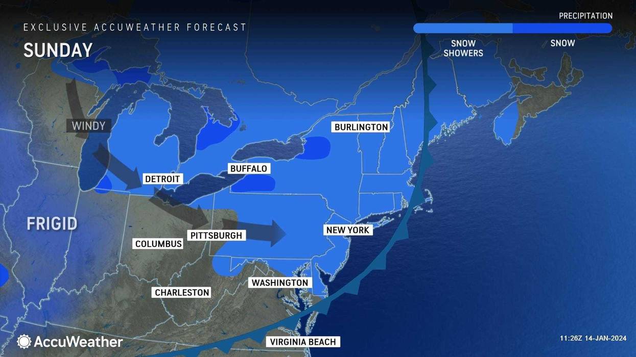
Sunday night will be mainly clear, brisk and cold, with lows ranging from teens in the suburbs to 23 in the city, according to AccuWeather.
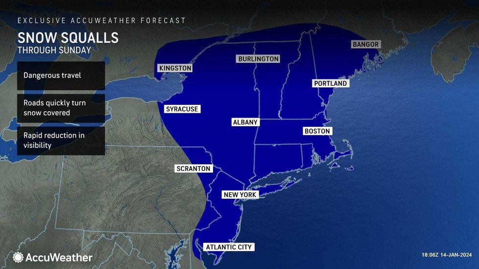
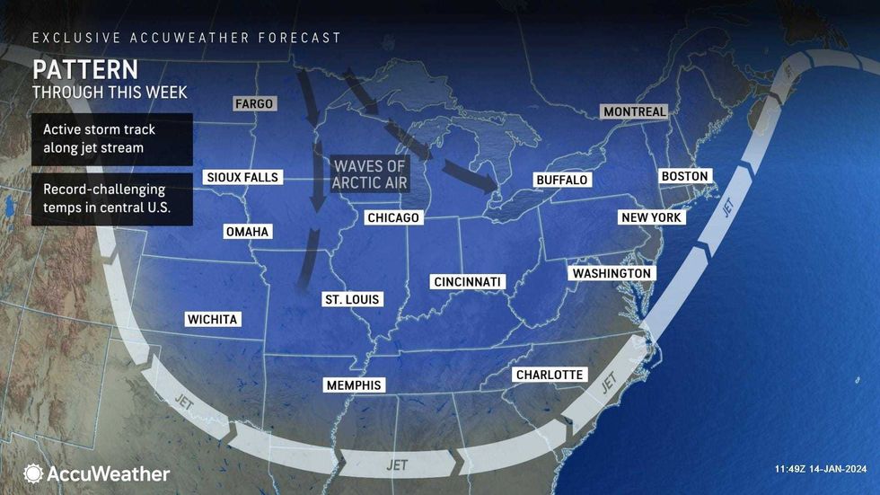
These freezing temperatures come in the aftermath of snow squalls across the city on Sunday afternoon, which caused rapid reduction in visibility, gusty winds and brief snow.
 AccuWeather
New York City Emergency Management issued a weather alert about the squalls on Saturday. In the city, the squalls hit hardest between 12 p.m. and 3 p.m. and manifested from an arctic cold front that swept through the region during the afternoon.
The Department of Sanitation pre-treated high spots, highways and areas prone to icing in anticipation of the squalls, and encouraged New Yorkers to exercise caution on the road.
The National Weather Service New York NY posted information on the afternoon's snow squalls, which were localized. The worst of the squalls hit the northern and interior sections.
According to the NWS, snow squalls last for about 15 to 30 minutes, can bring winds from 40 to 50 mph and up to half an inch of snow accumulation.
At around 3:30 p.m., NYCEM lifted its weather alert regarding the snow, though a Wind Advisory remains in place citywide.
Amid freezing temperatures, a Cold Blue was also put in place across the city through Monday at 8 a.m., NYC 311 announced.
Twenty New Jersey counties joined NYC in issuing a Cold Blue as temperatures plummet, including Essex, Bergen, Passaic and Hudson Counties.
These areas are bracing for the freeze as they continue to struggle in the wake of extreme flooding prompted by last week's rain storms.
On Saturday, the Passaic River – which has now receded to moderate flood stage from major flood stage – reached 11.34 feet, nearing its highest-ever record of 12.4 feet, and devastating nearby areas like Paterson.
Gov. Phil Murphy visited Paterson on Saturday to engage with the lasting problems plaguing the community.
"Visited Paterson this afternoon to see the flooding and hear from residents on how they've been impacted by back-to-back storms," Murphy wrote in a post on X. "To all impacted communities here in New Jersey, we are here for you and are committed to getting you the help you need from the federal government."
This devastation is mirrored along the southern shore of Long Island, where areas like Fire Island experienced massive beach erosion and flooding.
In his Sunday press conference, Senator Chuck Schumer called on federal agencies, specifically the Army Corps of Engineers, to provide aid to impacted areas and make emergency repairs.
"I'm announcing a new plan to help the Army Corps use that key to fund emergency rehab across Long Island. I'm demanding that the feds aggregate the back-to-back storms as one singular event. It is allowed by their rules, but they haven't done so," Schumer said.
In a report on Saturday, ABC7 said that the Army Corps of Engineers is aware of the situation but does not have the authority or funding to conduct emergency repairs.
"Public Law 84-99, governing emergency responses to disasters, has very strict guidelines: there must be substantial damage to structures and roads and prolonged disruption to utilities from a Category III Hurricane (winds of 110-129 MPH) or higher to be considered," officials said in a statement, as reported by ABC7.
"The New York District completed an analysis of the coastal storm events in September, determining they were not eligible for PL 84-99 assistance. This determination is currently being validated by other Army Corps Districts. Their determination should be completed later this month," the statement concluded.
At around 3 p.m. on Sunday, Gov. Kathy Hochul held a press conference to update New Yorkers on the ongoing severe weather.
Hochul said that the snow expected in the afternoon – until 5 p.m. in the Southtowns – was to continue at the same rate of snowfall it was already seeing.
This rate was anywhere from three to six inches per hour, more intense than previously thought, Hochul said. She noted that the forecast underestimated the ferocity of the storm, and the volume of snow falling in Western NY has exceeded expectations.
"We all know, as Western New Yorkers, how dangerous the triple threat is. The triple threat of icy, cold temperature, with high winds, and the blowing snow and how dangerous that all can be. It's life-threatening weather, that's exactly what's going on now," Hochul said.
Hochul had issued a travel ban across all of Erie County, and as the storm began to pass on Sunday, some areas had that ban lifted.
As of about 3:40 p.m. on Sunday, the ban was lifted in Grand Island, Tonawanda, Amherst, Clarence and Newstead, but remains in place in the "City of Buffalo & across central Erie County & the Southtowns due to ongoing blizzard-like conditions," Hochul said.
 AccuWeather
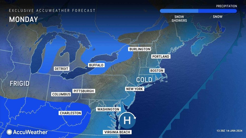
In NYC, Monday is supposed to be brisk and cold with peaks of clouds and sun, with a high of 33, according to AccuWeather. Temperatures will drop again at night, reaching a low of 25.
 AccuWeather
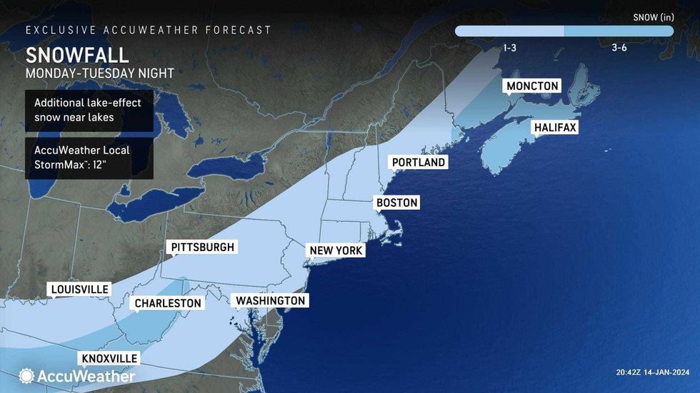
Snow will arrive late Monday night and continue into Tuesday, accumulating an inch or two and potentially breaking Central Park's no-snow streak, AccuWeather said.
Due to snow accumulations, travel could be slippery on the Tuesday morning commute, AccuWeather said. Tuesday's high will keep the city below freezing, at 31.
 AccuWeather
Looking midway through the work week, it will stay brisk and cold on Wednesday, with a high of 29, per AccuWeather.