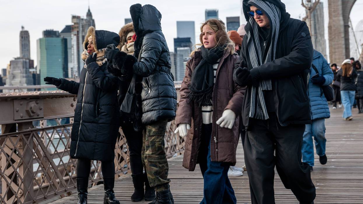
NEW YORK (1010 WINS) -- Bone-chilling cold was gripping the New York City area on Tuesday, with wind chills near zero degrees as Arctic air pours into the region.
NYC's coldest temperatures so far this winter were recorded Tuesday morning, including 16 degrees in Midtown with a wind chill of about zero. It's the coldest day since last January.
Tuesday's high will only reach 25 in Midtown, as blustery conditions push wind chills down to the single digits and teens.
 AccuWeather
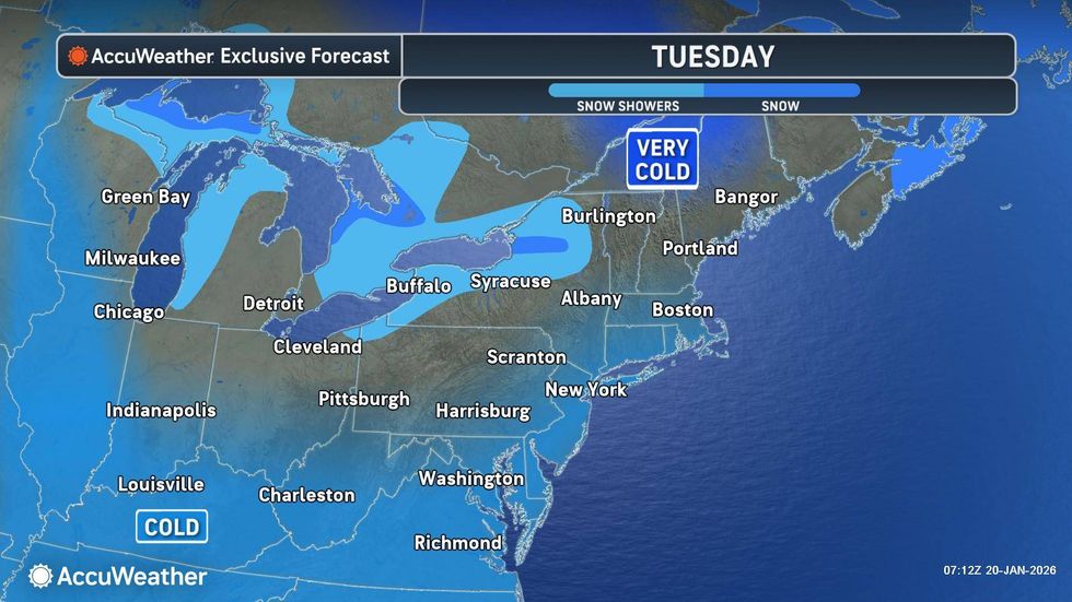
The cold will stick around Tuesday night and early Wednesday, with low temps around 14 in the city. Some suburbs will have single-digit temps.
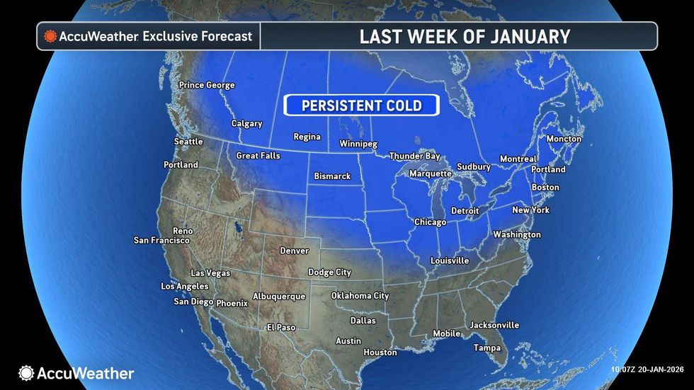
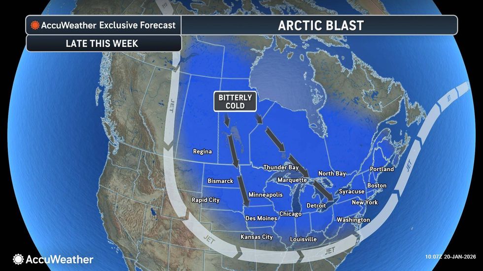
The dangerous Arctic air is coming down from Canada and stretching across a swath of the U.S. this week.
 AccuWeather
NYC Emergency Management warned, "These will be dangerous life-threatening conditions for anyone without proper winter clothing and gear outdoors or reliable heat indoors."
Highs will rise to 37 on Wednesday and to the low 40s on Thursday—before plunging again this weekend to the teens. Currently, it's looking like highs will only reach about 19 in NYC on Saturday and Sunday.
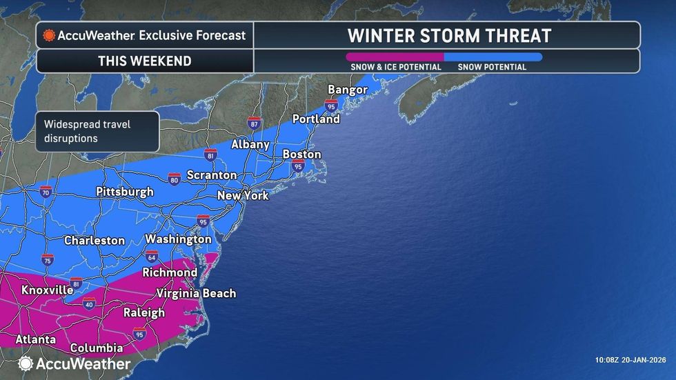
A major winter storm is also expected to barrel across the country this weekend, impacting the Mid-Atlantic states, and possibly the Northeast. Meteorologists are still watching the track of the storm, but it has the potential to bring snow to NYC.
 AccuWeather
 AccuWeather