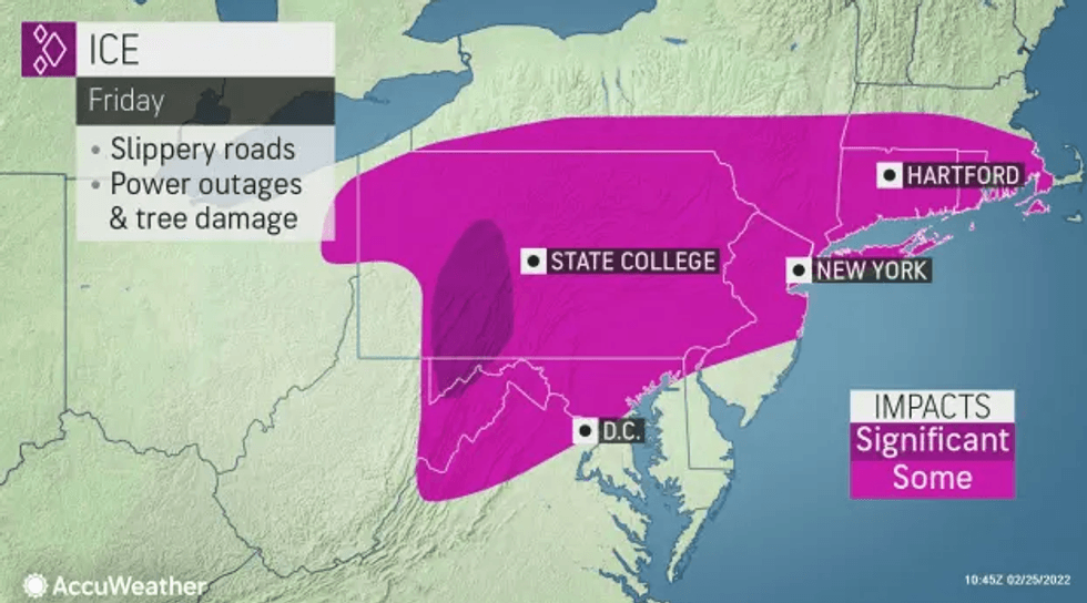
NEW YORK (1010 WINS) -- A wintry mix was wreaking havoc on New York City area roads Friday, with a number of accidents reported amid slushy and slippery travel conditions.
A winter weather advisory is in effect for a swath of the area—including New York City, Long Island, northern New Jersey, the Lower Hudson Valley and southwestern Connecticut—until late morning towards the coast and until the afternoon further inland.
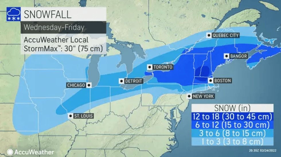
A wintry mix was changing over to rain in many areas along the coast by daybreak, according to AccuWeather. About an inch or so of sleet was expected before the changeover.
 AccuWeather
 AccuWeather
Rain will continue in the city and coastal suburbs through the early afternoon, however there may still be ice, slush and flooding in poor drainage areas.
It remains colder in the inland suburbs, including parts of New Jersey, which hadn't reached the freezing mark by the morning commute. A buildup of sleet and ice could cause problems all the way into the afternoon.
Distant suburbs to the northwest will continue to see sleet and snow throughout the day.
All precipitation should end by early afternoon, when the high will reach 40 degrees in the city and the mid-30s in the inland suburbs.
It's breezy and very cold Friday night, so watch for icy spots as wet areas freeze over. The low will reach 22 in the city and the teens in many suburbs.
Saturday is sunny but cold with a high of 34.
Temps rise to 44 on Sunday, when partly sunny skies may give way to a late rain or snow shower, especially to the northwest.