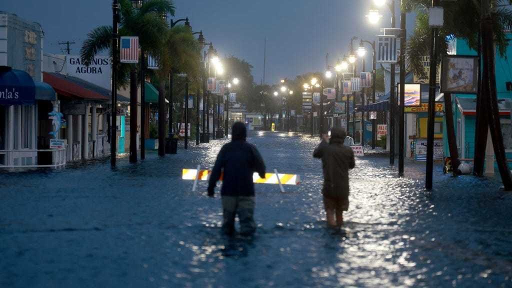


As Hurricane Idalia continues to smash into the Gulf Coast of Florida, bringing catastrophic winds and heavy rain, the added storm surge could worsen due to tonight’s moon.
Storm surge, or rising ocean water brought ashore by the storm, is one of the most dangerous factors brought on by hurricanes.
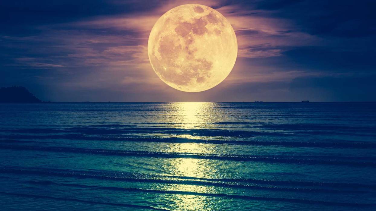
With normal tides, a storm surge can be deadly, but tonight, thanks to the full moon being a supermoon, meaning it’s the closest it ever gets to Earth, the tides will be near their strongest all year.
“I would say the timing is pretty bad for this one,” Brian Haines, a meteorologist with the National Weather Service, shared with The Associated Press.
Noah Petro, a research scientist at NASA Goddard Space Flight Center, shared with National Geographic that the added strength means added danger for those in coastal cities.
“The full moon can enhance the tides, and so certainly … at the time of high tide during the storm, you’re going to see greater coastal flooding,” Petro said.
However, even though the supermoon will be the closest of the year, the full moon phase matters more than it being a supermoon.
“It’s not a great added combination that it’s closer than normal,” Petro says. ”It’s going to be on the scales of centimeters, at most, of difference in tide—which in this case is barely even noticeable.”
Depending on the area, some parts of Florida are expected to see a storm surge of up to 16 feet, according to the National Hurricane Center.
Because of this, experts have said that the supermoon will most likely only have a modest effect due to the storm surge already expected from Idalia.
“It makes a big difference whether the storm makes landfall at low tide or at high tide. That can make a difference of up to five feet,” Thomas Wahl, associate professor of coastal engineering at the University of Central Florida, shared with NatGeo. “But then the storm surge of 10, 15 feet is the part that really makes it dangerous. Just the high tide itself is not going to pose any major threat to people.”
The highest tide is expected to come on Thursday afternoon, sometime after storm surge waters have started to retreat into the ocean.
Whether or not the moon plays a role, the storm is already being viewed as historic for its strength and where in the state it’s made landfall.
“This has the makings of an unprecedented event for this part of the state,” the National Weather Service in Tallahassee said. “There are NO major hurricanes in the historical dataset going back to 1851 that have tracked into Apalachee Bay. None.”