


LOS ANGELES - Light snow is falling at very low elevations around greater Los Angeles as a very cold storm passes through.
The Grapevine is reopened! @knxnews #knxtraffic https://t.co/pcsdk00uBi
— Denise Fondo (@FondoKNXTraffic) February 21, 2019
The Los Angeles County Fire Department air operations section posted video of snow falling in the Santa Monica Mountains above Malibu Thursday afternoon.
And actor Jerry O'Connell recorded video of himself as snow fell in nearby Calabasas.
Snowing in Calabasas! @RebeccaRomijn pic.twitter.com/GhoSVZc5WE
— Jerry O'Connell (@MrJerryOC) February 21, 2019The National Weather Service had said the snow level could lower to 1,000 feet (305 meters).
Snow in Rancho Cucamonga @ABC7 pic.twitter.com/zENGBzreFS
— D e s t y n e e (@DestyneeBryanne) February 21, 2019The snow level could drop down to 15-hundred feet.
@GaryandShannon This is Rancho Cucamonga now. pic.twitter.com/YkJfP21E4p
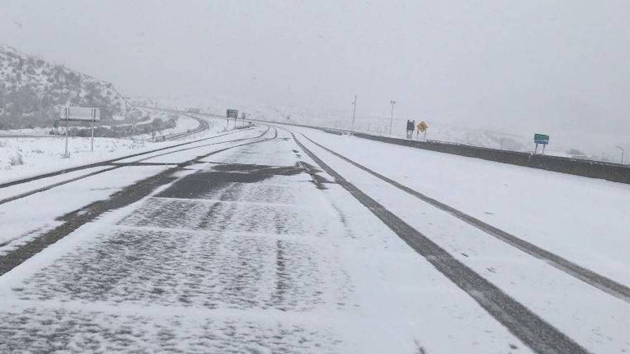
— Old Jedi -- (@vader317) February 21, 2019The Grapevine is CLOSED because of snow right now. Here's a live look from our cold, hardworking crew!More on the winter travel conditions: https://t.co/E8RmlNnZLJ https://t.co/VHXf4WvQw3
— BakersfieldNow (@bakersfieldnow) February 21, 2019Senior Meteorologist Scott Larrimore with The Weather Channel tells KNX the Hollywood Hills could possibly get a light dusting of snow as temperatures go down later today.
"Thankfully I think this weekend and into early next week we will see a return to the 60s and 70s, where we are used to camping out so it looks like it will be a short-lived event. But for the next couple of days, today, tonight and tomorrow we are talking some chilly numbers and unusually low snow levels," Larrimore said.
A freeze watch is in effect for the LosAngeles and Ventura County valleys.
Temperatures could drop to the upper 20s to low 30s. Larrimore says there could even be an isolated thunderstorm today.
A cold storm system will bring snow showers to Southern California through tonight and brought the snow level down to an unusually low 1,500 feet, National Weather Service forecasters said.
"This storm system will likely bring the lowest snow levels of the season, with snow levels locally falling to 1,500 feet or lower on Thursday," said an NWS statement.
"... There is the potential for brief snow showers in some areas that rarely see snow, such as the higher valleys of Los Angeles and Ventura counties, foothills, and Santa Monica mountains. Many roads will be affected due to the very low elevation snow levels," the statement warned.
#RoadClosure due to low snow level on Angeles Forest Hwy from Aliso Canyon Rd to Angeles Crest Hwy, Big Tujunga from Vogel Flat Rd to Angeles Forest Hwy, and Upper Big Tujunga from Angeles Forest Hwy to Angeles Crest Hwy #LAsnow ❄️ pic.twitter.com/8PToGybb2g
— LA Co Public Works (@LACoPublicWorks) February 20, 2019Forecasters said they expect snow accumulations of 1 to 4 inches, with 4 to 6 inches possible across the eastern San Gabriel Mountains in L.A. County, along with "dangerous winter weather driving conditions due to snow showers, icy roadways, and gusty winds."
Forecasters also urged motorists to be prepared for reduced visibility on some roadways, including Interstate 5 from The Grapevine to Santa Clarita and Highway 14, the Antelope Valley Freeway, through Soledad Canyon.
Snow fell on portions of the Antelope Valley (14) Freeway around 6 p.m. Wednesday but did not stick, although rain and hail were reported around 5:30 p.m. yesterday, causing some vehicles to slide.
The snow level in the San Gabriels was at between 3,000 and 3,500 feet Wednesday night and expected to fall to 2,000 feet today.
"Plan on slippery road conditions and be prepared for reduced visibility at times," warned the NWS statement. "Portions of highways 14 and 138 (Pearblossom Highway), mainly near the foothill communities could be impacted by light snow and icy roads."
In addition to prompting road closures and flooding, the storm forced a daylong closure of the Knott's Berry Farm and Six Flags Magic Mountain theme parks Wednesday. It also delayed play at the Genesis Open golf tournament at Riviera Country Club, and it forced the cancellation of a Hollywood Walk of Fame ceremony for rock band Aerosmith.
Off the coast, thunderstorms are expected through tonight as a result of the moist and unstable air mass in the region.
"Any thunderstorm that forms will be capable of producing local gale force winds and rough seas, dangerous lightning, heavy rainfall with reduced visibility, and waterspouts," said an NWS statement.
Also in effect today through Friday morning is a freeze watch. Temperatures are expected to drop to between 29 and 32 degrees Friday morning.
"A hard freeze can kill crops and sensitive vegetation and harm outdoor pets and livestock. Extended exposure to cold can cause hypothermia," noted an NWS statement. "A Freeze Watch means temperatures between 29 and 32 degrees or less will be possible for at least two consecutive hours. Protective measures to save outdoor plants may be needed. Vulnerable animals and pets should be kept indoors in a house or barn."
Forecasters said a cold system will move into the area Friday afternoon, likely dropping the snow level to about 4,000 feet, but with far less likelihood of rain than Wednesday and today.
The NWS forecast showers in L.A. County today and highs of 35 on Moun Wilson; 44 in Palmdale and Lancaster; 50 in Saugus; 52 in Avalon; 54 in Pasadena, San Gabriel and Burbank; 55 in Woodland Hills; 56 in Downtown L-A and at LAX. Sunny skies are forecast Friday and Saturday, followed by four partly cloudy days in the 60s.
Radar Loop as of 430 AM. Expect scattered shower activity to continue thru the day. #cawx #larain pic.twitter.com/6jJRXvT0rz
— NWS Los Angeles (@NWSLosAngeles) February 21, 2019A combination of showers and partly cloudy skies was forecast in Orange County today, along with highs of 29 degrees on Santiago Peak; 44 on Ortega Highway at 2,600 feet; 50 in Fremont Canyon; 51 in Trabuco Canyon; 53 in Yorba Linda and San Clemente; 54 in Mission Viejo and Laguna Beach; 55 in Newport Beach; 56 in Anaheim; and 57 in Fullerton and Irvine. Sunny skies and temperatures in the 50s and 60sare forecast through Tuesday followed by a partly cloudy day.
The story is contributed to by CNS and Associated Press