
LOS ANGELES (KNX) — A winter storm warning will be in effect from 1 a.m. Wednesday to 4 a.m. Friday, according to the National Weather Service, for Los Angeles County Mountains, excluding the Santa Monica Range.
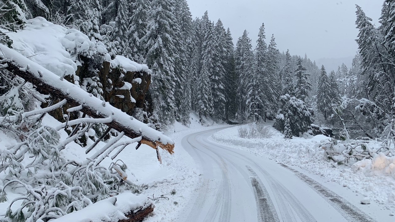
NWS issued the alert Tuesday afternoon, saying heavy snow is expected, with a total accumulation of likely between one and three feet.

"Generally, the snow level will be above 5000, but light snow could fall as low as 4000 feet early on and at the end of the storm," NWS said.
"Winds gusting as high as 35 mph to 40 mph. At higher elevation this could be as high as gusts to 60 mph."
Forecasters are expected the heavy snowfall to make for difficult travel, likely impossible in some areas, according to NWS.
Mountain roadways that could be affected by the heavy snowfall include Angeles Crest Highway, Mt. Baldy Road and Highway 39 in L.A. County.
Forecasters are expecting the storm to bring some heavy downpours to the region, with storm rain totals beteween two and six inches expected wherever the winter storm "stalls."
"Elsewhere, more modest totals of 0.5 to 2 inches of rain and 6 to 12 inches of snow are expected," NWS told City News Service.
If you travel:
- Keep an extra flashlight, food and water in your vehicle in case of an emergency.
- Always check road conditions before leaving. The latest from Caltrans can be found by calling 1-800-427-7623 or by clickng here.
Follow KNX News 97.1 FM
Twitter | Facebook | Instagram
Related
