


Northern California's Caldor Fire continues to burn in El Dorado County, threatening more than 20,000 structures in its path. Cal Fire issued an immediate order to evacuate for residents of South Lake Tahoe on Monday.
According to Cal Fire, a mandatory evacuation order "is defined as an immediate threat to life." All previous evacuation orders and warnings also remain in effect, according to officials.
-The Tahoe Keys community and all residents accessed from the streets connected to Tahoe Keys Blvd, staying east of 3rd Street.
-East of Highway 50/ Highway 89 at the Lake Tahoe Blvd and Highway 89 Highway 50 intersection. This includes the area of Barton Hospital and the area of Winnemucca to the "Y". Also north of Highway 50 west of Tahoe Keys Blvd following along the north side of Highway 89 through the end of town prior to Pope Beach.
-Lakeview west of Highway 50 North of Blue Lakes Road and east of Tahoe Keys Neighborhood. Sierra Tract
-Both sides of Highway 50 for the streets connected to O'Malley, Lodi, Silver Dollar and Rubicon Trail.
-Between Al Tahoe on the east side of Johnson Blvd to include the streets of Treehaven and Fremont and extending to the east into all residences west of Ski Run and east of Pioneer Trail.
Residents have been told to evacuate eastbound on Highway 50 towards Nevada, but huge numbers of evacuating residents resulted in gridlock on the freeway. The traffic backup extended over nine miles.
Evacuation Shelters can be found at Truckee Veterans Hall at 10214 High Street in Truckee, and Douglas County Community Center at 1329 Waterloo Lane in Gardnerville, NV.
On Sunday, fire officials ordered more evacuations near Lake Tahoe and told other residents to be ready to leave, not long after several structures were destroyed along Highway 50, according to The Associated Press. Highway 50 is one of the main routes to the south end of the lake.
The fire is burning near Little Mountain, south of Pollock Pines in El Dorado County, prompting evacuation orders and warnings in a large swath of several mountain communities.
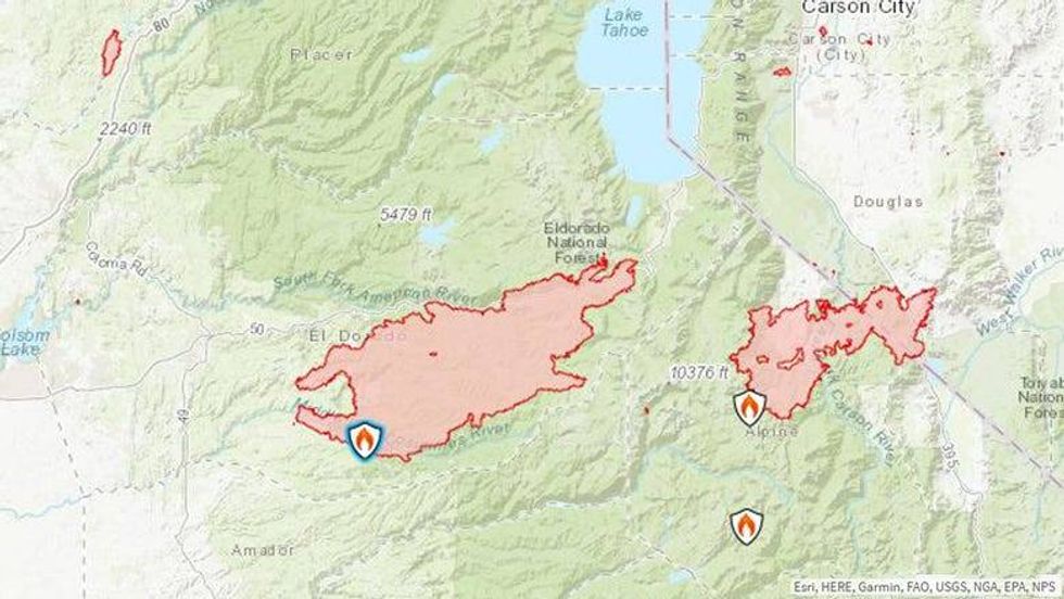 The U.S. Forest Service shared this map of the Caldor Fire with latest acreage on Monday, Aug. 30, 2021.U.S. Forest Service
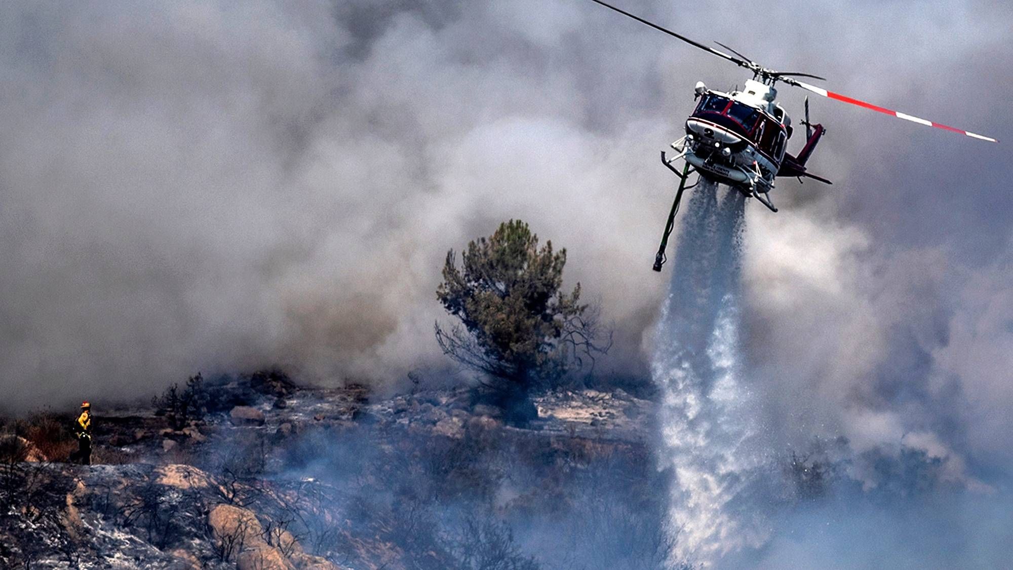
Through poor weather conditions, thousands of firefighters with Cal Fire, the U.S. Forest Service and other local agencies are working on fire suppression efforts and structure protection.
"Humidity recovery remained poor overnight and allowed the fire to continue to actively burn," Cal Fire said in an update Monday. "Current fire behavior is contributing to ember casts traveling up to half a mile. We anticipate early morning winds in the northeast area of the fire. Fire weakened trees continue to present a risk for crews."
To date, at least 39 structures have been destroyed, two civilians have been injured and three firefighters have been injured
To protect both the public and firefighters across the state, the USDA Forest Service Pacific Southwest Region temporarily closed nine National Forests.
The closure affects the Tahoe National Forest, Lake Tahoe Basin Management Unit, Plumas National Forest, Lassen National Forest, Mendocino National Forest, Klamath National Forest, Six Rivers National Forest, Shasta-Trinity National Forest and Modoc National Forest.
Closures are in effect through Sept. 6, at 11:59 p.m.
Highway closures:
- Highway 88 is closed between Omo Ranch Road and the Highway 88/89 interchange.
- High 50 is closed from Pollock Pines to Meyers in El Dorado County.
- For the latest highway closure updates from Caltrans, click here.
The Caldor Fire broke out two weeks ago on Saturday, Aug. 14 around 7 p.m. The cause remains under investigation. Due to weather and rough terrain, it's proved so difficult that fire managers have pushed back the projected containment date from early this week to Sept. 8. However, they've since indicated that the date may be pushed back again if current conditions continue.
Evacuation orders are in place in El Dorado and Alpine counties. For a list of current evacuation orders and warnings, click here.
Fire Resources: Cal Fire AEU, El Dorado National Forest, USFS, El Dorado County Sheriff


