


California's massive Dixie Fire, now 489,287 acres, has officially become the second-largest wildfire in state history. As of Aug. 9, it is just 21% contained, according to the United States Forest Service.
The Dixie Fire began on July 13 in Plumas County and later merged with the Fly Fire, which ignited on July 22. Currently, it is tearing through the Plumas National Forest, Lassen National Forest, Lassen Volcanic National Park and Butte, Lassen, Plumas and Tehama Counties.
Reports from the USFWS link the active fire behavior to drought, strong winds, and dry, hot weather in the region.
So far at least 400 structures have been destroyed and thousands of people are under evacuation orders as the nearly month-long fire continues to burn. 14,000 more structures are threatened, according to NPR.
Among the areas devastated by the fire is the small, census-designated town of Greenville. The L.A. Times reports some 67 structures were destroyed by the Dixie Fire in the town just southeast of Lake Almanor.
Images captured by photographers with the Associated Press show the devastation. In neighborhoods, entire blocks were left decimated, with only chimneys, rubble and burned out cars remaining. In addition, the whole of Greenville's historic downtown is gone, according to a statement from Plumas County Supervisor Kevin Goss, to the L.A. Times.
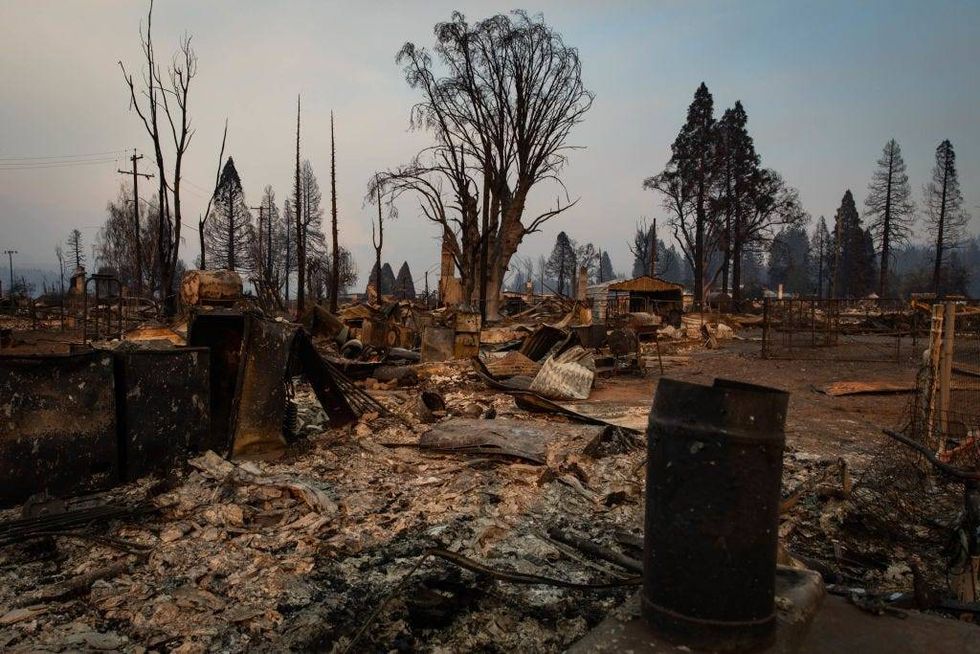 The last of the day's light makes the burned landscape glow on August 8, 2021 in Greenville, California. The Dixie Fire, which has incinerated more than 463,000 acres, is the second-largest recorded wildfire in state history and remains only 21 percent contained.Maranie R. Staab/Getty Images
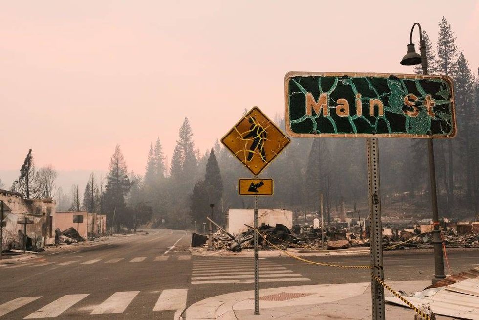 Street signs burned by the Dixie Fire stand on the corner of Highway 89 and Main Street on August 8, 2021 in Greenville, California. The Dixie Fire, which has incinerated more than 463,000 acres, is the second-largest recorded wildfire in state history and remains only 21 percent contained.David Odisho/Getty Images
Law enforcement officers in the areas in and around the Dixie Fire urged residents to remain evacuated. For a list of current evacuations and shelter locations, click here.
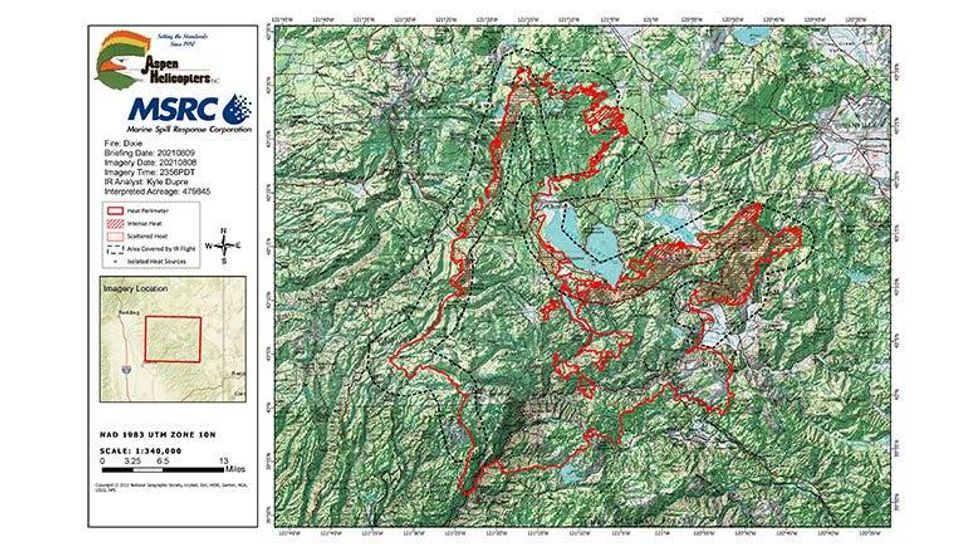 An infrared map provided by the USFS on Aug. 9, 2021 indicates the heat and heat perimeter of the Dixie Fire.United States Forest Service
While two reports filed by PG&E indicate equipment may have been involved in starting the Dixie Fire, no official cause has been determined.


