After an amazing Aurora evening across the northern hemisphere, things are calming down this morning. Believe it or not, there are a few showers dotting areas north of Hwy 380 this morning, but they're not going to amount to too much. Hot and dry is our weather story through the weekend y'all!
We're waking up to a few showers north of the Dallas-Fort Worth area this morning, but most of you will stay dry. Temperatures are mainly in the 60s under a partly cloudy sky. Clouds will move out today with afternoon highs near 90°.
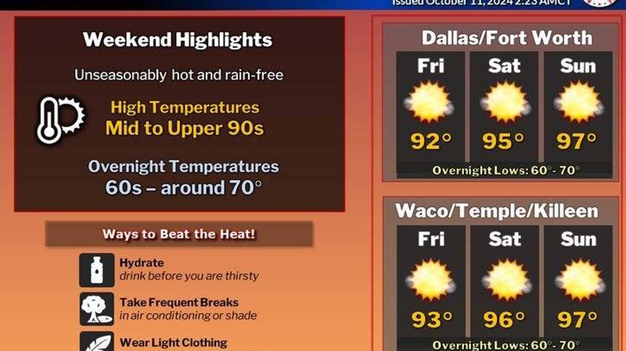
An area of high pressure will strengthen over the area this weekend with near record heat. Record highs both Saturday and Sunday are at 97°. We'll come close, especially on Sunday as a cold front bears down on us by late evening.
 NWS
NWS
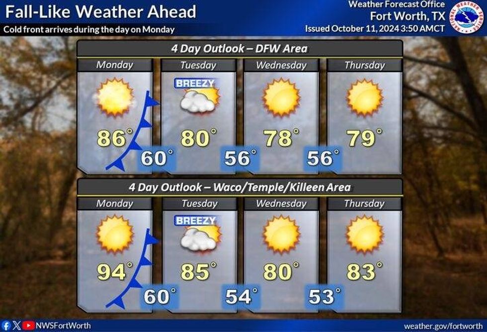
This cold front will move through the area overnight into Monday morning producing no rain. It will be breezy and cooler on Monday with highs and a low to mid 80s.
Morning lows will dip into the 50s on Tuesday and Wednesday morning, with afternoon highs in the upper 70s. It might be a bit cooler than that depending on how deep this front penetrates the area.
Our slow warm up starts on Thursday with highs back in the low 80s. Our next weather change arrives not this weekend, but next weekend, as a more significant cold front cruises through the area. It might even bring some rain with it! Stay tuned.
 NWS
NWS
Have a great weekend and try to enjoy the weather when you can, it's the only weather you've got!
____________________________
7-Day Headlines:
* DFW Airport reached 89 yesterday.
* A few sprinkles around this morning, north of DFW.
* A VERY warm weekend ahead.
* 90s during the Texas/OU game.
* Cold front early Monday. No rain with it.
* Cooler Tuesday - Thursday, but seasonable!
_____________________________________________________
*Yest Rain: 0.00"; Yest High: 89; Low: 69
*Today's Averages: High: 81; Low: 59
*Record high: 99 (1999); Record low: 42 (1905, 1932, 1990)
__________________________________________________________
*October Rain: 0.00"; Deficit:
*2024 Rain: 33.94"; Surplus: 5.54"
*Sunrise: 7:30am; Sunset: 6:59pm
__________________________________________________________
Today: *Air Quality Alert* Morning clouds, sprinkles north, then mostly sunny and warm. High: Near 90. Wind: South 10-20 mph.
Tonight: Clear and comfortable. Low: 65-70. Wind: South 5-10 mph.
Tomorrow: Ample sunshine and warm for Texas/OU. High: Mid 90s. Wind: SSW 15-25 mph.
Sunday: More of the same. Sunny and hot. Late Sunday evening cold front, but no rain with it. High: Mid 90s.
Monday: Sunny, windy and cooler. High: Low to mid 80s.
Tuesday and Wednesday: Sunny, windy and fall-like! High: Mid to upper 70s.
Thursday: Sunny and a tad warmer. High: Low 80s.
LISTEN on the Audacy App
Tell your Smart Speaker to "PLAY 1080 KRLD"
Sign Up to receive our KRLD Insider Newsletter for more news
Follow us on Facebook | Twitter | Instagram | YouTube