Average totals over the weekend were between 1.00" to 3.00", with the heaviest rain north of DFW, DFW Airport measured about 3/4 of an inch. Our surplus is just below 7.00" for the year!
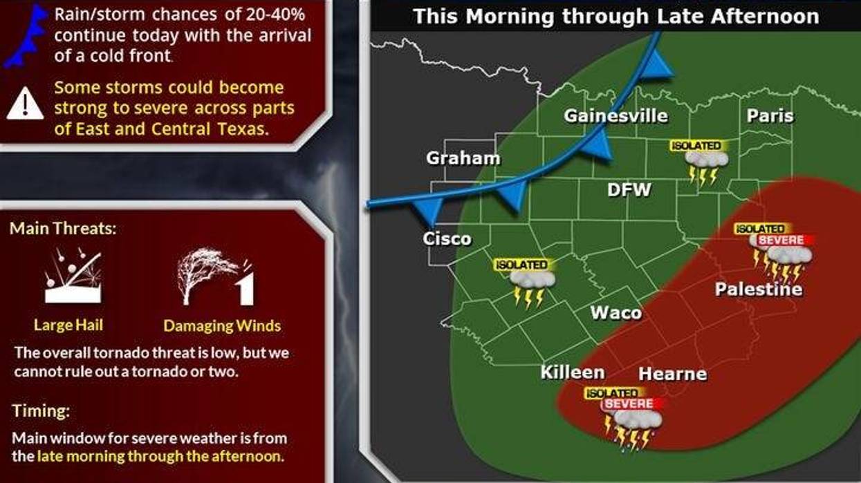
We're waking up to temperatures in the 60s this morning, along with some patchy drizzle and areas of fog. I'm also tracking a weak cold front that's heading our direction from West Texas. This front will arrive this afternoon promoting a few scattered showers and storms. The best chance for rain, and some of this will become severe, will be well to the southeast of us. Heads up if you're heading down towards San Antonio, College Station or Houston later today. It could get pretty rough. Looks like we'll dodge any severe weather threat here across north Texas, but I can't rule out a few scattered showers and storms as the front comes through today. Afternoon highs will top out near 80°.
Skies will clear overnight tonight with morning lows between 55 and 62 degrees. It'll be a nice comfortable morning tomorrow. We'll warm up quickly into the mid-80s by afternoon, with plenty of sunshine.
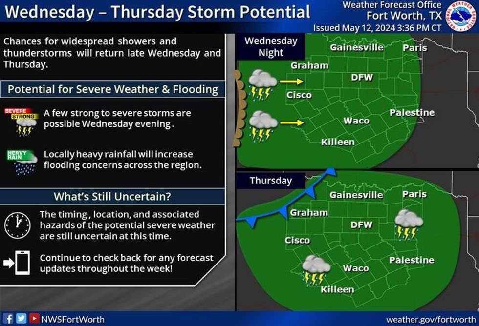
Our active west-to-east flow in the upper levels of the atmosphere will drive another system in our direction late Wednesday through the first half of Friday. Waves of showers and storms are expected. Some of them may become severe. I will keep you posted as we get closer. Highs on Wednesday will reach the upper 80s, cooling into the mid-70s on Thursday due to the clouds and rain in the area. A few leftover showers and storms are possible the first half of Friday with highs in the low 80s.
 NWS
NWS
A ridge of high pressure in the upper levels will build across the area into the weekend, shutting off rain chances except for possibly late Saturday evening. This is the warming effect y'all! Plenty of sunshine Saturday with highs in the mid to upper 80s...low 90s for Sunday with a ton of humidity.
7-Day Headlines:
* DFW Airport reached 68 yesterday. 0.78" of rain.
* A few showers north this morning. Isolated severe storms this afternoon (south and east).
* A decent Tuesday and Wednesday ahead. Warming up.
* More storms late Wednesday into Thursday. Some severe.
* Heating up this weekend. Very humid. A few storms late Saturday.
_____________________________________________________
*Yest Rain: 0.78"; Yest High: 68; Low: 65
*Today's Averages: High: 83; Low: 64
*Record high: 95 (1956) Record low: 43 (1971)
__________________________________________________________
*May Rain: 3.17"; Surplus: 1.36"
*2024 Rain: 20.44"; Surplus: 6.82"
*Sunrise: 6:30am; Sunset: 8:19pm
__________________________________________________________
Today: Morning fog and showers north, some afternoon sun. Isolated afternoon storms along a cold front. Severe and flooding risk well SE of DFW. High: Near 80. Wind: NW 10-20 mph.
Tonight: Mostly clear and cool. Low: 56-61. Wind: NW 5-10 mph.
Tomorrow: Mostly sunny and warmer. High: Mid 80s. Wind: NNE 5-10 mph.
Wednesday: Partly cloudy, warm and humid. Scattered storms return late. Some severe. High: Upper 80s.
Thursday: Cloudy and mild. Scattered showers and storms. Some severe. High: Mid 70s.
Friday: A few leftover showers. High: Low 80s.
Saturday: Mostly sunny, warm and humid. Isolated evening storms. High: Mid to upper 80s.
Sunday: Partly cloudy, hot and humid. High: Low 90s.
LISTEN on the Audacy App
Tell your Smart Speaker to "PLAY 1080 KRLD"
Sign Up to receive our KRLD Insider Newsletter for more news
Follow us on Facebook | Twitter | Instagram | YouTube