


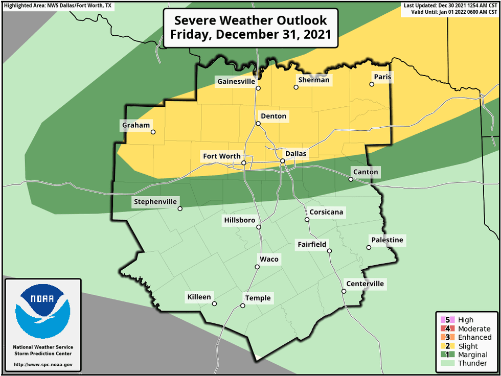
12/30 2:20P UDPATE: The threat warning for severe weather is now back to level one by the storm prediction center for Friday evening into early Saturday morning for areas north of Interstate 20. Heaviest rain will be in Oklahoma. I'm still thinking less than a 1/2 of an inch of rain across North Texas... The brief Arctic air blast will be the biggest story!
 NOAA
NOAA
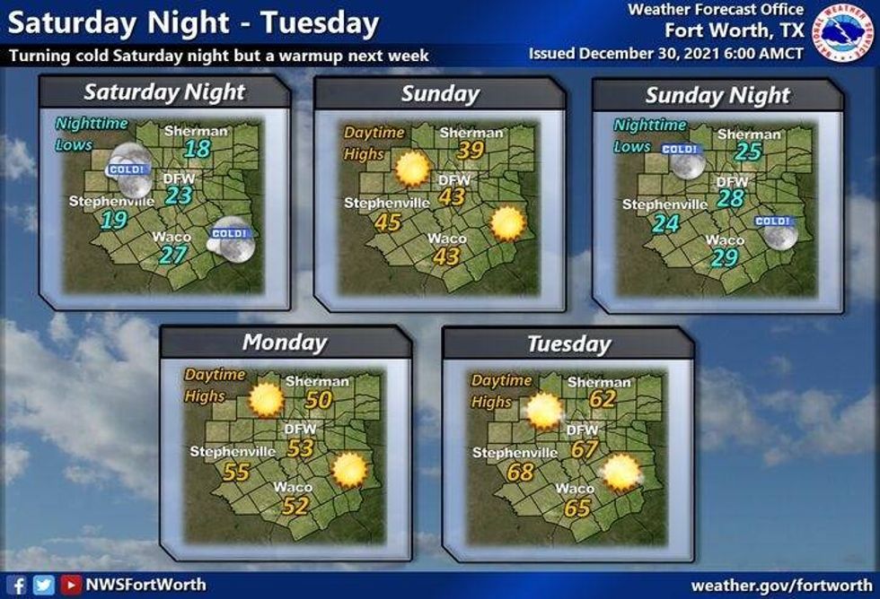
The big weather change will be the brief arcrtic cold snap we will experience starting Saturday afternoon through Monday.
A very hard freeze is expected for Sunday morning with temperatures 18 to 24゚... Make sure your outdoor faucets are covered and insulated and PLEASE, Don't forget about your pets and plants... Also, let your faucets drip along exterior walls and open all cabinet doors where plumbing resides. This allows indoor heat to help keep them warm.
 NWS
NWS
Note: It's still not out of the question we may see some flakes of snow around here late Saturday into early Sunday morning while you're sleeping. Best chances will be in east Texas.
LISTEN on the Audacy App
Sign Up and Follow NewsRadio 1080 KRLD


