


A few of you saw some heavy rain and some severe weather late yesterday, but things have quieted down this morning as expected. There may be a few isolated showers east of Dallas before noon but it's doubtful.
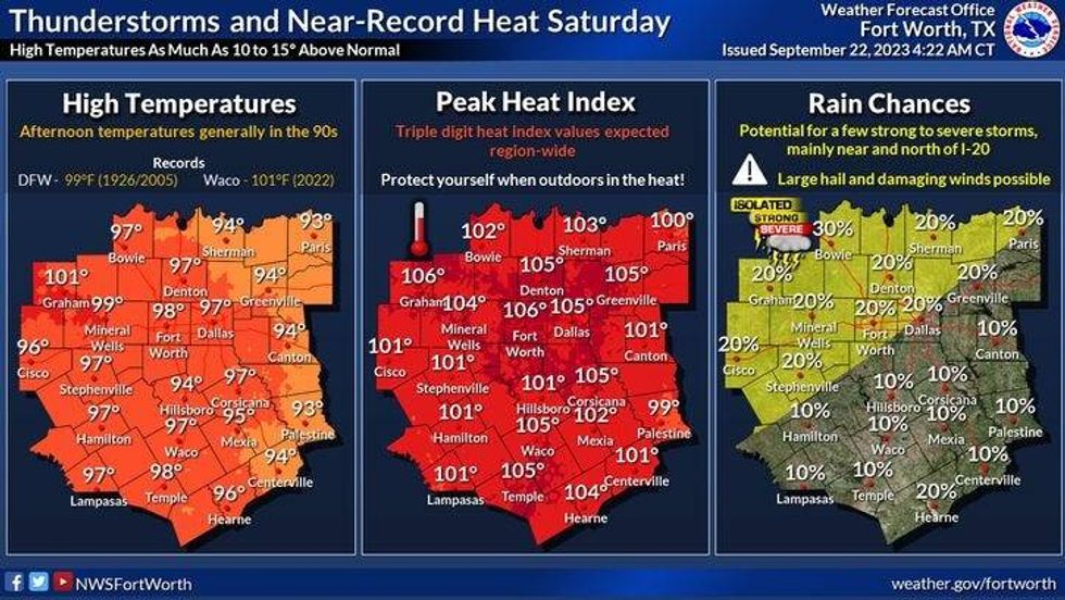
Welcome to the last day of summer. And boy it'll feel like it with afternoon highs back in the mid 90s again. No rain is in the forecast.
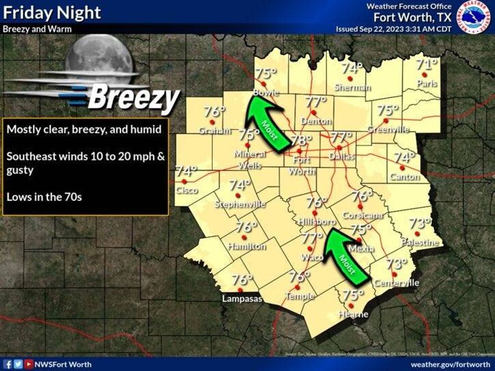
If you're heading to any of the high school football games this evening, dress appropriately with shorts & short sleeves. It will be a little bit breezy with a south wind gusting to 20 mph.
 National Weather Service - Fort Worth
Tomorrow will be warm and windy again with a very slight chance of a late day storm. Most will stay dry. Afternoon highs will top out in the middle 90s once again as Fall arrives early tomorrow morning.
 National Weather Service - Fort Worth
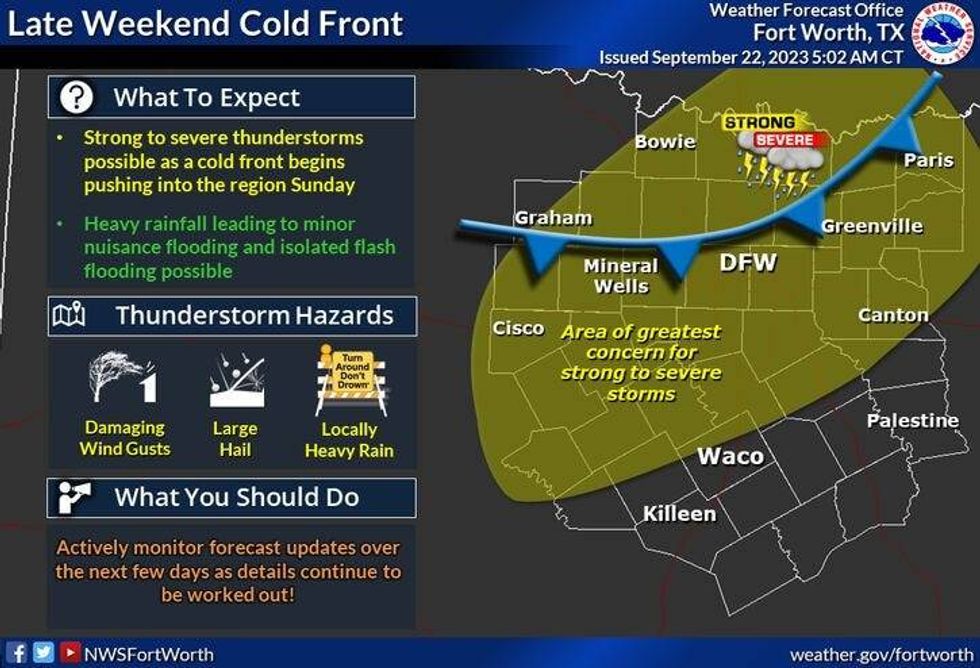
Our best chance of rain over the next 7 days arrives late Sunday into early Monday morning, as a slow moving cold front comes through the area. I'm not overly convinced that everyone will see rain, but those that do, especially across the southeastern half of North Texas, where a few of the storms may become severe. Hail and wind will be the threats. Afternoon highs on Sunday will reach the upper 90s before the clouds and rain move in.
 National Weather Service - Fort Worth
There may be a few leftover showers and storms along and south of I-20 the first half of Monday, with slow clearing to the north. Afternoon highs will be cooler with readings only in the middle 80s.
Tuesday through Thursday look delightful with near average temperatures and lower humidity. Daytime highs will reach the mid 80s with morning lows in the 60s. There might even be some upper 50s in the outlying areas on Tuesday and Wednesday. A slow warm up returns Thursday into Friday, which is the opening day of the State Fair of Texas. I'm forecasting highs and the low 90s by then.
*Yest Rain: 0.00"; Yest High: 96; Low: 76
*Today's Averages: High: 87; Low: 67
*Record high: 101 (2005): Record low: 45 (1983)
*September Rain: 0.60"; Deficit: 1.40"
*2023 Rain: 15.43"; Deficit: 11.12"
*Sunrise: 7:16am; Sunset: 7:25pm
Today: Partly cloudy, warm and breezy. High: Mid 90s. Wind: South 10-20 mph.
Tonight: Partly cloudy, breezy and mild. Low: Low to mid 70s. Wind: South 10-20 mph.
Saturday: *First day of Fall (1:50am)* Partly cloudy, breezy and warm. A slight chance of afternoon and evening showers and storms. High: Mid 90s.
Sunday: Partly to mostly cloudy, windy and warm. Scattered late day showers and storms. Some severe. High: Mid to upper 90s.
Monday - Wednesday: Mostly sunny, cooler with lower humidity. Highs: Mid 80s.
Thursday: Sunny and warmer. High: Near 90.
LISTEN on the Audacy App
Tell your Smart Speaker to "PLAY 1080 KRLD"
Sign Up to receive our KRLD Insider Newsletter for more news
Follow us on Facebook | Twitter | Instagram | YouTube


