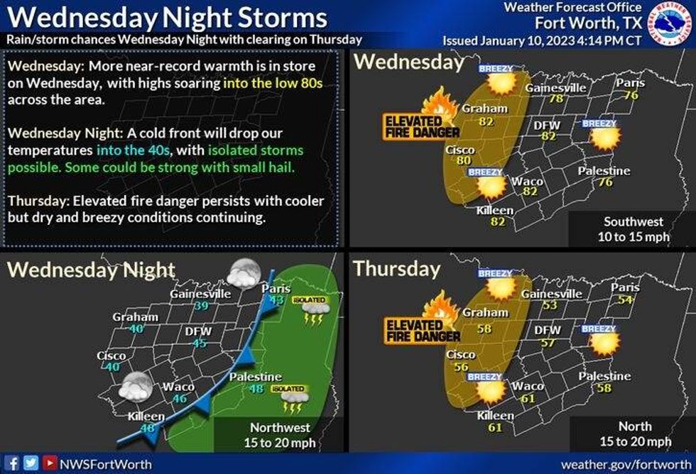
We're starting off this morning in the 50s. This is where we should be during the afternoon hours. Plenty of high cloud cover today, Breezy southwest winds will cause temperatures to soar into the low 80s again.
As you probably know, we broke the record high yesterday and we'll most likely tie or break it again today. The record for today is 83° set back in 1911. And ironically, on January 31st, 1911, we recorded the hottest temperature ever in the month of January was 95°. A grass fire danger will once again be high today as well.
 National Weather Service - Fort Worth
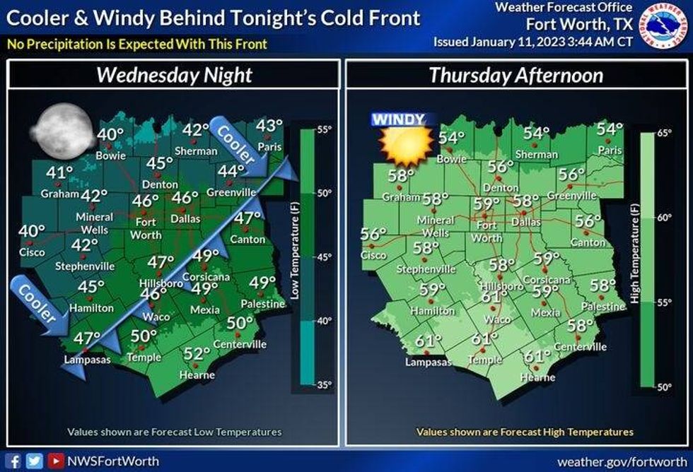
By this time tomorrow morning, a strong cold front will have moved through. The wind will shift to the north and gust to 30 mph throughout the day. Morning lows will be in the 40s, afternoon highs will struggle to get above 55° under a clear sky.
 National Weather Service - Fort Worth
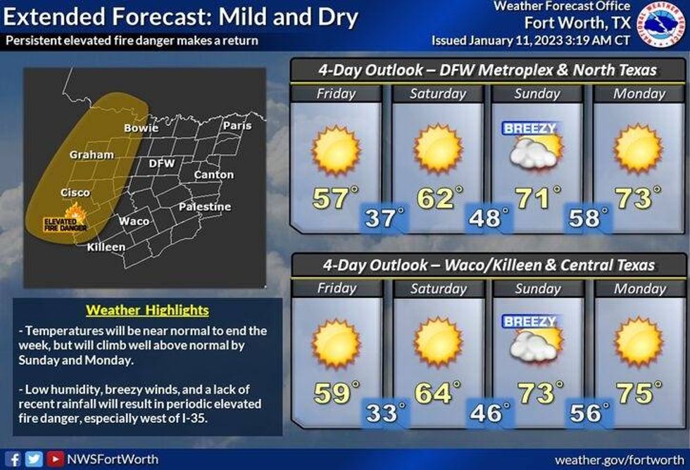
Friday morning's temperatures will be near freezing away from town, mid-thirties in the immediate DFW area. Be sure to protect your plants and bring your pets indoors. Faucets do not need to drip. Afternoon highs will approach 60° with plenty of sunshine.
Our warm up continues into the holiday weekend. A south wind returns and will gust to 30 mph, especially on Sunday and Monday. Afternoon highs will be in the mid 60s Saturday, low 70s on Monday, and a little cooler, mid-60s for Tuesday.
 National Weather Service - Fort Worth
Right now, it looks like we may see some measurable rain, maybe even some thunderstorms by next Wednesday. After that, we may see a significant pattern change trending colder towards the end of the month.
*Yest Rain: 0.00"; High: 83R; Low: 44
*Today's Averages: High: 56; Low: 36
*Record high: 83 (1911); Record low: 4 (1918)
*January rain: Trace; Deficit: 0.87"
*2023 rain: Trace; Deficit: 0.87"
*Sunrise: 7:31am; Sunset: 5:41pm
Today: HIgh clouds, windy and warm. Near record high again. Grass fire danger. High: Low 80s (Record 83, 1911). Wind: SW 15-25, 30 mph.
Tonight: Clearing, windy, turning colder before sunrise. Low: Low to mid 40s. Wind: NNW 15-25, G30 mph.
Thursday: Sunny, windy and cooler. Grass fire danger. High: Mid 50s. Wind: NNW 15-25, G30 mph.
Friday: A chilly start. Plenty of sunshine. Cool, with less wind. High: Upper 50s.
Saturday: High clouds, breezy and a bit warmer. Grass fire danger. High: Mid 60s.
Sunday: High clouds, windy and mild. Grass fire danger. High: Near 70.
Monday: High clouds, windy and mild. Grass fire danger. High: Low 70s.
Tuesday: Weak cold front. A bit cooler. High: Low to mid 60s.

LISTEN on the Audacy App
Tell your Smart Speaker to "PLAY 1080 KRLD"
Sign Up and Follow NewsRadio 1080 KRLD