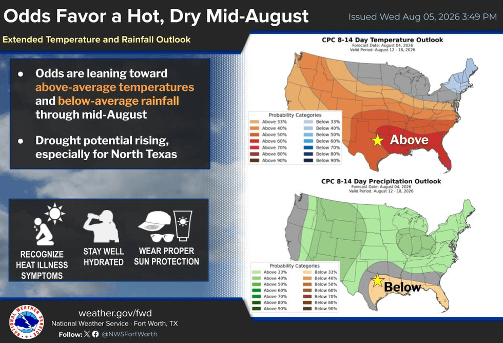
It's August, ladies and gentlemen, and the weather is certainly acting like it! Temperatures will remain a few degrees above average over the next seven days, with precipitation virtually non-existent as a large dome of high pressure over the southwestern United States continues to dominate our weather pattern.
Next week, another upper-level ridge of high pressure will develop in the southeastern US and back-build into Texas, keeping us hot and dry through next week and into the following weekend. Afternoon highs will once again climb above the 100-degree mark.
Good morning, everyone, and welcome to almost Friday! I hope you've had a great work week so far. Between back-to-school shopping for the kids and trying to stay cool, it's been a busy week. My best advice is to stay indoors as much as possible during the hottest part of the day. If you work outdoors, be sure to take frequent breaks, stay hydrated, wear sunscreen, and put on a hat to help beat the heat. And as always, check the back seat before leaving your vehicle.
This is typical weather for early August. The past three days have all reached 101° at DFW Airport, and I wouldn't be surprised if we hit that mark again today. The good news is humidity levels continue to mix out during the afternoon, keeping the highest heat index values around 104°, and that should continue through the weekend. Heat Advisories are expected to remain mainly across Oklahoma.
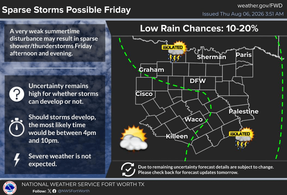
Any rain in the forecast? Not much. There is a slight chance late Friday evening that an area of thunderstorms over Oklahoma could sag into our northern counties, mainly north of Highway 380. However, the ridge of high pressure is strong and should weaken most storms before they reach the Dallas-Fort Worth area. I'll keep a close eye on it just in case, but after that, the forecast is dry through the weekend and all of next week.
High temperatures will stay near 100° this weekend, around 101° on Monday and Tuesday, then possibly climb into the 103° to 105° range by the middle and latter part of next week.
Remember, this is the hottest time of the year. Our average high is 97°, and the average low is 77°. The good news is that after August 15, those averages begin a slow downward trend as we inch closer to fall.
And by the way—who's counting? I am! We've officially recorded 13 triple-digit days so far this year.
Enjoy the weather when you can... it's the only weather you've got!
7-Day Headlines:
- DFW Airport hit 101 degrees on Wednesday
- 13 triples this summer
- 22 day with no rain at DFW
- No Heat Advisories….for now
- Triple digits through next week
- Isolated showers and storms east and north of DFW on Friday
- Download our AUDACY app! Listen to KRLD LIVE at home or at work
Almanac:
- Yest Rain: 0.00”; Yest High: 101; Low: 81
- Today’s Averages: High: 97; Low: 77
- Record high: 109 (2003); Record low 65 (1912, 1990)
- August rain: 0.00”; Deficit: <0.28”>
- 2026 Rain: 22.61”; Snow: 2.4”; Deficit: <0.04”>
- Sunrise: 6:46am; Sunset: 8:21pm
Forecast:
Thursday: Mostly sunny and hot. High:101. Heat index: 104. Wind: South 5-10 mph.
Thursday night: Clear and warm. Low: Near 80. Wind: South 5-10 mph.
Friday: Partly cloudy and hot. Isolated late-day showers and storms north and east of DFW by evening. High: 101. Heat index: 104.
Weekend: Partly cloudy and hot. High: near 100.
Monday: Mostly sunny and hot. High: 101.
Tuesday: More of the same. Sunny and hot. High: 102
Wednesday: Go away heat! High: 102.
LISTEN on the Audacy App
Tell your Smart Speaker to "PLAY 1080 KRLD"
Sign Up to receive our KRLD Insider Newsletter for more news
Follow us on Facebook | Twitter | Instagram | YouTube