


An active weather pattern is returning to North Texas!
We're starting Wednesday with unseasonably mild temperatures. Readings have only fallen into the low to mid-60s with some low clouds starting to sneak in from the south.
Today will be relatively quiet under a partly cloudy sky. Afternoon highs will warm into the low 80s. The average high this time of the year is 68°.
 National Weather Service - Fort Worth
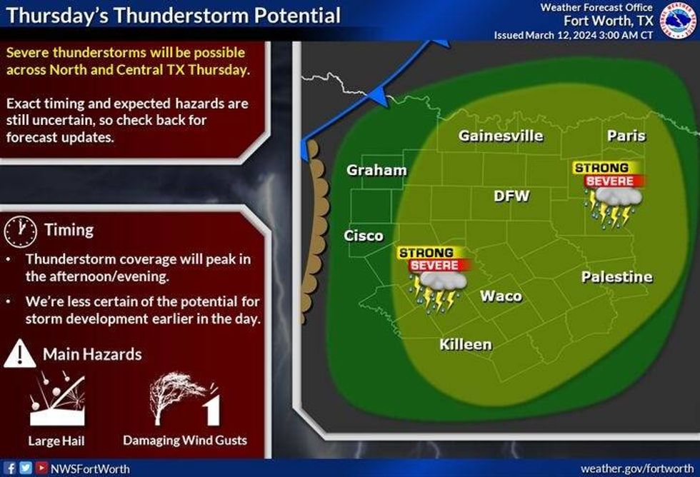
A strong area of low pressure in the upper levels of the atmosphere is digging into the desert southwest. Spokes of energy will cruise across Texas starting tomorrow, lasting through the weekend. A cold front will also move through the area early Friday morning. In the meantime, south winds continue to pump in the Gulf of Mexico's moisture. This moisture will interact with the dryline as it moves in from west Texas tomorrow afternoon and evening. Scattered showers and isolated severe storms will break out, mainly along and east of Interstate 35W. Hail, damaging wind, and an isolated tornado are the threats. Afternoon highs will top out in the upper 70s.
 NOAA - National Weather Service - Fort Worth
Any storms that do form will race northeast through the late evening giving way for a cold front to come through the area after midnight. High temperatures on Friday will be a little bit cooler with readings in the mid-60s. The next disturbance will ride up and over this cooler air giving us a decent shot of scattered showers and non-severe storms during the day.
Our next disturbance will arrive on Saturday. There's another chance for scattered showers across much of North Texas, however, the heaviest rain will fall to the south of DFW. High temperatures will once again reach the mid-60s.
A few leftover showers are possible for St Patrick's Day with highs approaching 70°.
Another cold front will arrive on Monday dropping temperatures into the upper 50s for highs. Low 60s on Tuesday. There will be some rain to the west of north Texas on Monday and Tuesday, but as of now it looks to stay out of our area.
*Yest Rain: 0.00"; Yest High: 74 Low: 54
*Today's Averages: High: 68; Low: 47
*Record high: 92 (1933); Record low: 23 (1922, 1950)
*March Rain: 2.77"; Surplus: 1.46"
*2024 Rain: 7.91"; Surplus: 1.31"
*Sunrise: 7:40am; Sunset: 7:35pm
LISTEN on the Audacy App
Tell your Smart Speaker to "PLAY 1080 KRLD"
Sign Up to receive our KRLD Insider Newsletter for more news
Follow us on Facebook | Twitter | Instagram | YouTube


