We are still in May, and the threat of strong to severe thunderstorms persists in my 7-day forecast. Some strong to severe storms will impact your holiday weekend.
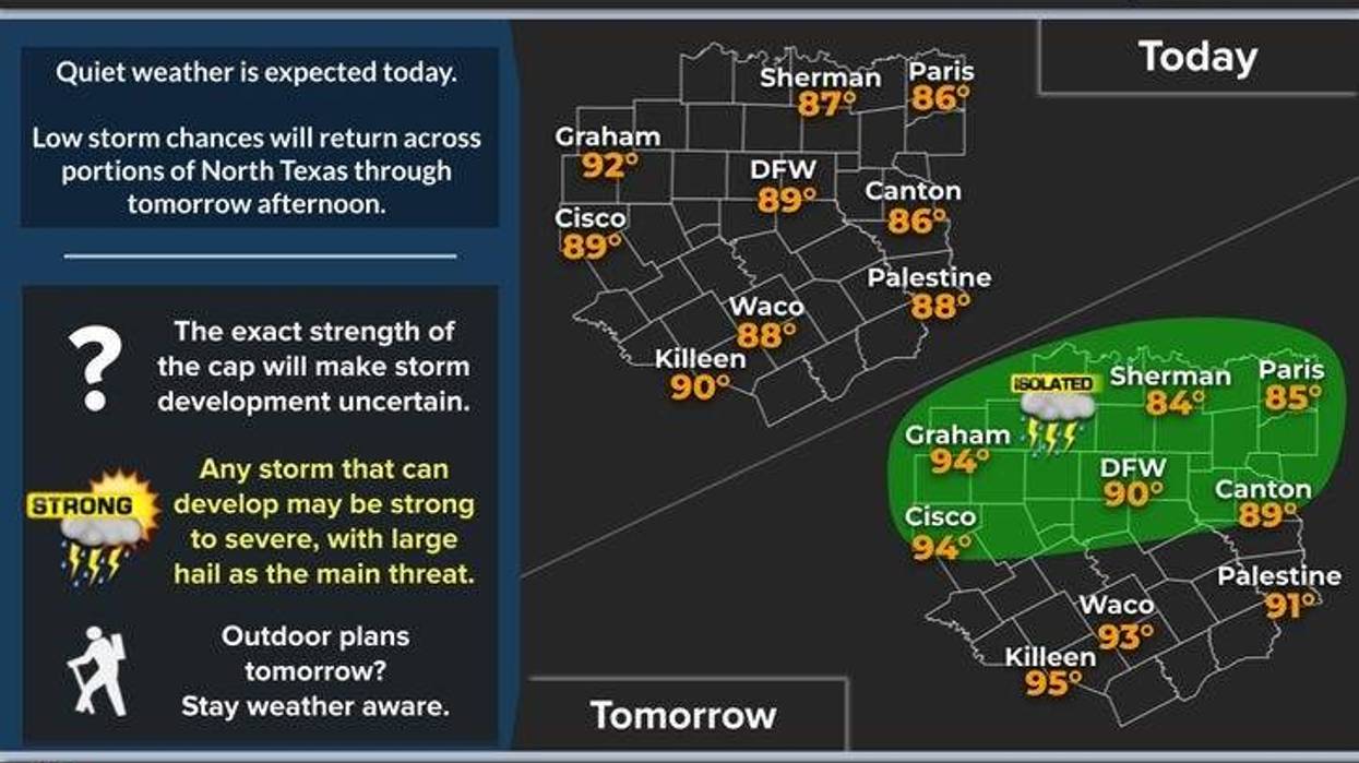
We are waking up to a mainly clear sky with a nice half moon and Venus shining brightly on the Eastern Horizon. Temperatures are comfortable, ranging from 55 to 64 degrees. We can expect plenty of sunshine today, with afternoon highs reaching the upper 80s.
Our next weather maker will rapidly approach Thursday afternoon into the evening. A cold front will stall close to the Dallas-Fort Worth area, producing showers and thunderstorms, some of which may become severe with hail and damaging wind. These storms will form into a complex and move in from the Northwest during the evening and early Friday morning. I am not overly concerned about a tornado threat.
The weather will clear up on Friday, and this nice weather will continue into Saturday and most of Sunday. Afternoon highs will reach the upper 80s on Friday and the low 90s on both Saturday and Sunday.
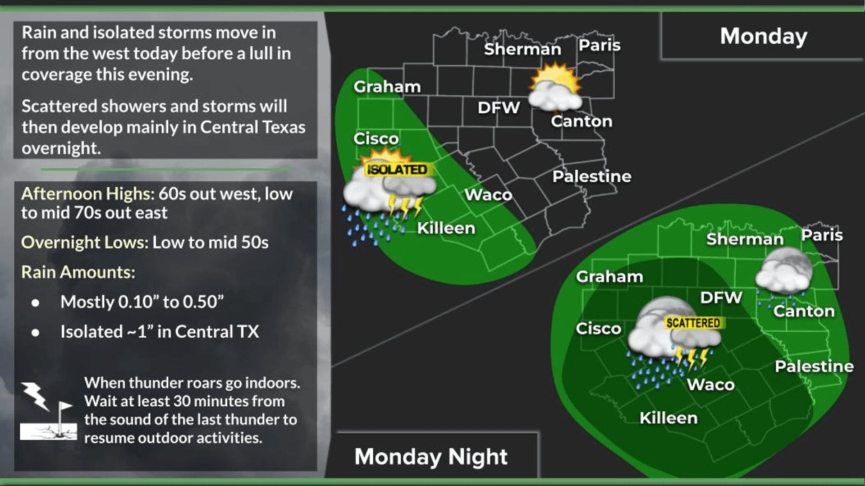
Another weather system will approach from the Northwest on Sunday night. The cold front will wait until Monday to come through, but enough disturbance combined with the dry line will produce numerous showers and thunderstorms off to our west by late afternoon. We may get a good old-fashioned Texas Squall line plowing through here towards midnight. Threats include smaller hail and damaging wind, as well as a small tornado threat along the leading edge of any Squall line. These tornadoes are usually brief and weak but can cause damage.
The cold front will move through the area slowly on Monday. I expect more showers and storms to form along this front and move Southeast through the evening. We may see another round of storms around here, but it depends on the frontal position during peak heating hours. I will be monitoring the situation. This is day 6 of my 7-day forecast, and the timing is subject to change.
The front should be far enough South on Tuesday to give us a nice and cool day. We can expect plenty of sunshine, with afternoon highs only in the mid-70s. A north wind will blow at 10 to 20 mph, making for a delightful day. Have a terrific day today, and please enjoy the weather when you can, it's the only weather you've got.
________________________________________________________________
7-Day Headlines:
* DFW Airport reached 84 yesterday.
* Another nice day today.
* Scattered showers and storms return late Thursday.
* Partly cloudy and very warm Friday - Sunday.
* More storms, some severe late Sunday into Monday morning.
* Cooler next week!
_____________________________________________________
*Yest Rain: 0.00"; Yest High: 84; Low: 68
*Today's Averages: High: 86; Low: 66
*Record high: 99 (2005); Record low: 51 (1947)
__________________________________________________________
*May Rain: 2.31"; Deficit:
*2025 Rain: 16.24"; Surplus: 1.31"
*Sunrise: 6:35am; Sunset: 8:25pm
__________________________________________________________
Today: Partly cloudy and warm. High: Upper 80s. Wind: South 5-10 mph.
Tonight: Partly cloudy and mild. Low: Low to mid 60s. Wind: South 5-10 mph.
Tomorrow: Partly to mostly cloudy and warm. Scattered showers and isolated severe storms (5pm-midnight). High: Low 90s. Wind: South 5-10 mph.
Friday: Partly cloudy and warm. Isolated late day storms (west of DFW). Upper 80s.
Saturday: Partly cloudy, warm, breezy and humid. High: Low 90s.
Sunday: Partly to mostly cloudy, warm and humid. Scattered late day showers and storms, some severe. High: Low 90s.
Monday: Mostly cloudy and cool. Scattered showers and storms. High: Mid to upper 70s.
Tuesday: Sunny and perfect. High: Mid 70s.
LISTEN on the Audacy App
Tell your Smart Speaker to "PLAY 1080 KRLD"
Sign Up to receive our KRLD Insider Newsletter for more news
Follow us on Facebook | Twitter | Instagram | YouTube