This week's weather highlights will include two cold fronts, one Wed. and another one on Fri. Right now, it looks like both fronts will bring a chance for scatt showers & storms, mainly east of DFW. I'm buying that scenario for Wed., but not for Fri. into the weekend. Stay tuned.
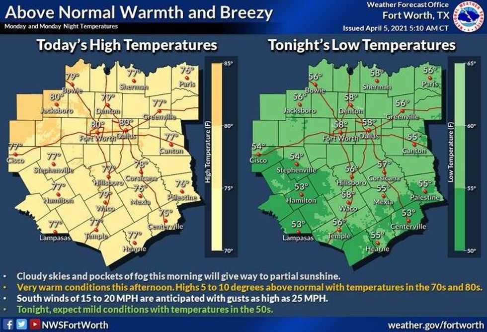
In the meantime, we're waking up to temps in the mid to upper 50s under a fair sky. There is a deck of stratus clouds about 130 mls south of DFW. Some of these may sneak into the area by mid morning, but will not produce rain.
Temps will warm nicely today to near 80゚ as south winds pick up a gust to 30 mph. This being said, it's opening day for the Texas Rangers in Arlington! A little birdie told me that the roof will be OPEN so dress as if you'll be outside watching a game. Shorts and a T-shirt should do you just fine! Go Rangers!
 NWS
NWS
Tomorrow's weather looks OK if you don't mind morning clouds and a lot of wind! Clouds should mix out by afternoon as temps warm into the low 80s. Wind will gust from the south to 40mph the 2nd half of the day.
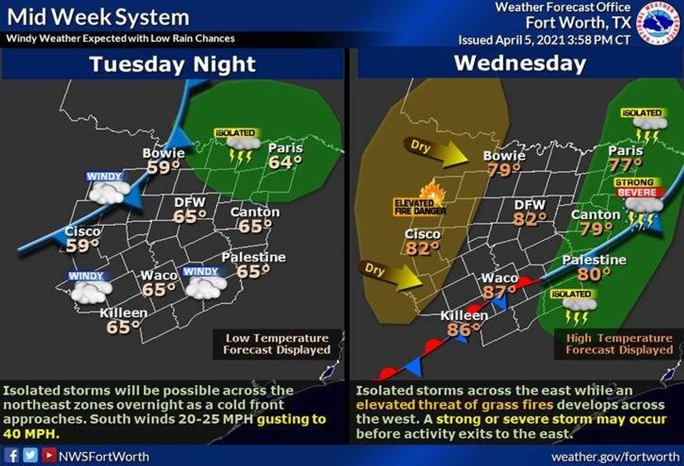
Our next subtle weather change will arrive sometime around noon Wed. A weak cold front will come through the area and may produce a few isolated showers and storms anywhere across north TX. Right now, it looks like more numerous storms will be confined to far east TX were a level 1 & 2 for hail and wind are forecast. Behind the front, wind will go northerly drying the air out significantly. Afternoon highs will still hit 80゚
 NWS
NWS
A very comfortable morning is in store for Thursday with lows near 50゚, afternoon highs warm into the upper 70s. This is still above average (73) for this time of the year.
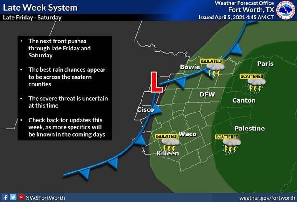
On Friday, another cold front will slowly press into the area. It's still way too early to tell where and how many storms will form, but it bares watching.
Scattered strong storms may linger into the weekend. Right now, mainly east of DFW.
Enjoy your day and the weather, it's the only weather you've got!
 NWS
NWS
7-Day Headlines:
* Above normal temperatures/Below normal rainfall
* Windy today - Wednesday
* Wednesday WEAK cold front, slight chance of showers and storms.
* Slight chance of showers and storms Friday - Sunday
* Trending wetter by the middle of the month?
________________________________________________________
*Yest Rain: 0.00"; *Yest High: 75; Low: 52
*Today's Averages: High: 74; Low: 52
*Record high: 89 (1930. 1935); Record low: 32 (1920)
_________________________________________________________
*April rain: 0.00"; April deficit: ">
*2021 Rain: 6.10"; 2021 deficit: ">
*Sunrise: 7:10am; Sunset: 7:51pm
_________________________________________________________
Today: Morning clouds, afternoon sun. Windy and warm. High: Near 80. Wind: South 15-25, G35 mph.
Tonight: Increasing clouds. Breezy and mild. Low: Near 60. Wind: South 15-25 mph.
Tomorrow: Morning clouds, patchy drizzle, peeks of afternoon sunshine. Windy and warm. High: Low 80s. Wind: South 15-25, G35 mph.
Wednesday: Morning clouds, afternoon sun and cold front. Slight chance of showers and storms. High: Near 80.
Thursday: Mostly sunny and pleasant. Less humidity. High: Mid to upper 70s.
Friday: Partly cloudy and warm. Slight chance for a late day storm. High: Low to mid 80s.
Weekend. Partly to mostly cloudy and warm. Slight chance for late day showers and storms. High: Near 80.