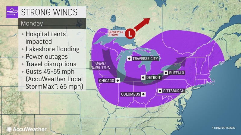

* WHAT...Southwest winds 30 to 40 mph with gusts up to 60 mph expected.
* WHERE...Niagara, Orleans, Monroe, Erie, Genesee, and Wyoming counties.
* WHEN...From 10 AM this morning to 2 AM EDT Tuesday.
* IMPACTS...Damaging winds will blow down trees and power lines. Widespread power outages are expected. Travel will be difficult, especially for high profile vehicles.
PRECAUTIONARY/PREPAREDNESS ACTIONS... People should avoid being outside in forested areas and around trees and branches. Use caution if you must drive.
LAKESHORE FLOOD WARNING REMAINS IN EFFECT FROM NOON TODAY TO 8 AM EDT TUESDAY...
* WHAT...Significant lakeshore flooding expected.
* WHERE...Niagara, Erie, and Chautauqua counties.
* WHEN...From noon today to 8 AM EDT Tuesday.
* IMPACTS...The rapid rise in water levels will result in lakeshore flooding along the Lake Erie and Upper Niagara River shores. Along the Lake Erie shore, flooding is expected along Route 5 in Hamburg, Buffalo Harbor and Canalside, Dunkirk Harbor, and other flood prone locations. Along the Upper Niagara River, flooding is likely to affect Grand Island and Cayuga Island. Very high wave action will also result in significant shoreline erosion.
